MyTopo
Platte City Missouri US Topo Map
Couldn't load pickup availability
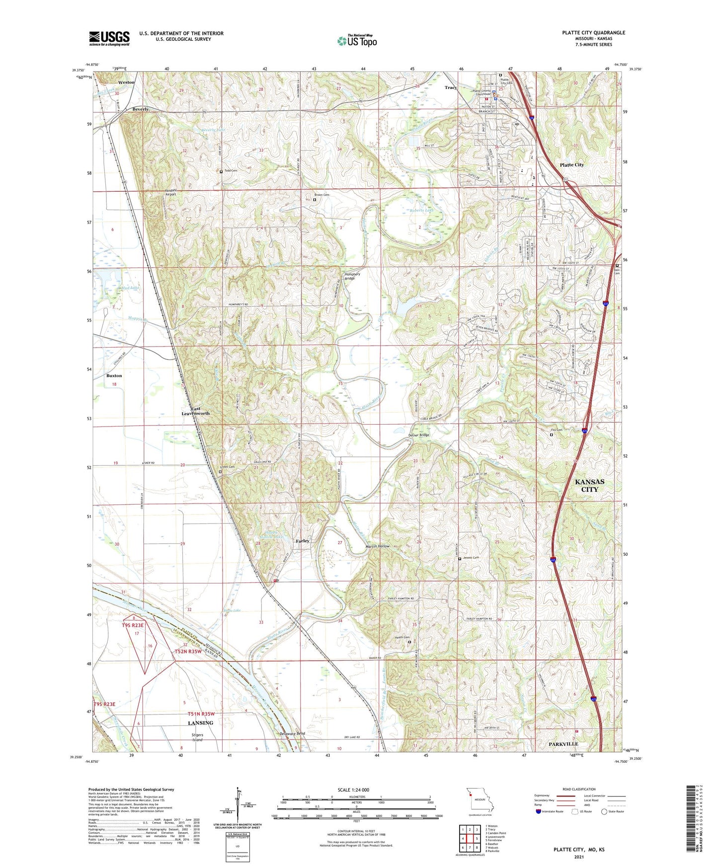
2021 topographic map quadrangle Platte City in the states of Missouri, Kansas. Scale: 1:24000. Based on the newly updated USGS 7.5' US Topo map series, this map is in the following counties: Platte, Leavenworth. The map contains contour data, water features, and other items you are used to seeing on USGS maps, but also has updated roads and other features. This is the next generation of topographic maps. Printed on high-quality waterproof paper with UV fade-resistant inks.
Quads adjacent to this one:
West: Leavenworth
Northwest: Weston
North: Tracy
Northeast: Camden Point
East: Ferrelview
Southeast: Parkville
South: Wolcott
Southwest: Basehor
This map covers the same area as the classic USGS quad with code o39094c7.
Contains the following named places: Bain Cemetery, Beverly, Beverly Lake, Big Creek, Brown Cemetery, Burns Lake, Buxton, Central Platte Fire Protection District, City of Platte City, Delaware Bend, Detner Bridge, Dry Lake, East Leavenworth, Eldorado School, Elm Grove Church, Elton Field, Farley, Farley Post Office, Fouts Branch, Fox Cemetery, Fox Creek, Gibson Branch, Green Cemetery, Hackberry School, Happy Hollow Lake, Happy Hollow Lake Dam, Heath Cemetery, Hettich Branch, Hickory Grove Church, Hillsboro Church, Horseshoe Lake, Humphery Bridge, Jewett Cemetery, Lanter Branch, Lanter School, Martin Hollow, Moore School, Moppin Branch, Morton School, Mud Lake, Northland Career Center, Odie Branch, Paxton School, Platte City, Platte City Cemetery, Platte City Middle School, Platte City Police Department, Platte City Post Office, Platte County High School, Platte County Sheriff's Office, Platte River, Platte Valley Airport, Prairie Creek, Rising Star Elementary School, Roberts Lake, Sand Branch, Siegrist Elementary School, Southern Platte Fire Protection District Station 2, Southern Platte Fire Protection District Station 4, Stigers Island, Todd Cemetery, Township of Kickapoo, Township of Lee, Vandahl Airport, Village of Farley, ZIP Code: 64079