MyTopo
Westphalia East Missouri US Topo Map
Couldn't load pickup availability
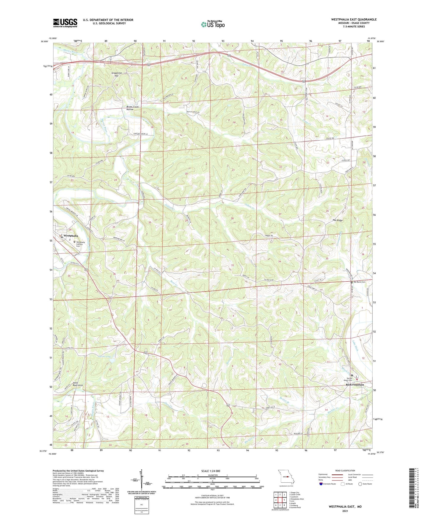
2021 topographic map quadrangle Westphalia East in the state of Missouri. Scale: 1:24000. Based on the newly updated USGS 7.5' US Topo map series, this map is in the following counties: Osage. The map contains contour data, water features, and other items you are used to seeing on USGS maps, but also has updated roads and other features. This is the next generation of topographic maps. Printed on high-quality waterproof paper with UV fade-resistant inks.
Quads adjacent to this one:
West: Westphalia West
Northwest: Osage City
North: Loose Creek
Northeast: Luystown
East: Linn
Southeast: Summerfield
South: Freeburg
Southwest: Argyle
Contains the following named places: Anvil Rock Arch, Bear Creek, Bexten Branch, Boy Scout Camp, Brush Creek Hollow, Buchler Creek, Buckendorf School, Church of the Sacred Heart, Deer Creek, Descher School, Fatima High School, Freeburg Volunteer Fire Department Station 2, Grapevine Hill, Indian Creek, Lake Ditch, Luecke Lake, Luecke Lake Dam, McDaniel School, Pea Ridge, Rich Fountain, Sacred Heart Cemetery, Township of Washington, Van Buren Cemetery, Westphalia, Westphalia Catholic Cemetery, Westphalia Post Office, Winkelman School, ZIP Code: 65054