MyTopo
Summerfield Missouri US Topo Map
Couldn't load pickup availability
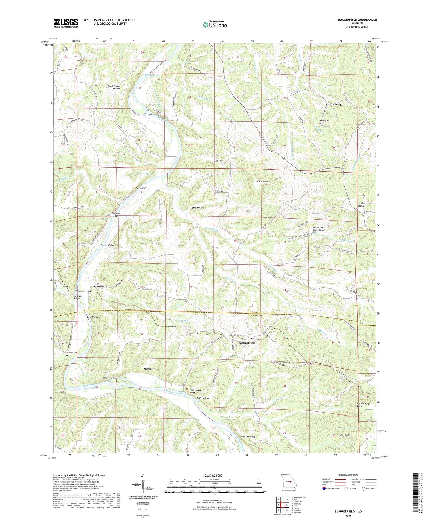
2021 topographic map quadrangle Summerfield in the state of Missouri. Scale: 1:24000. Based on the newly updated USGS 7.5' US Topo map series, this map is in the following counties: Osage, Maries. The map contains contour data, water features, and other items you are used to seeing on USGS maps, but also has updated roads and other features. This is the next generation of topographic maps. Printed on high-quality waterproof paper with UV fade-resistant inks.
Quads adjacent to this one:
West: Freeburg
Northwest: Westphalia East
North: Linn
Northeast: Cooper Hill
East: Belle
Southeast: High Gate
South: Paydown
Southwest: Vienna
This map covers the same area as the classic USGS quad with code o38091c7.
Contains the following named places: Baker Creek, Boehmer Hollow, Branson Cemetery, Buck Elk Branch, Buck Elk Creek, Buck Elk School, Cave Bluff, Daggetts Ford, Fish Hollow, Fish Hollow Bluff, Gascondy, Hatchee Bluff, Hatchee Creek, Hoops Ford, Huckleberry Bluff, Indian Creek School, Keeney Bluff, Knight Hollow, Koenig, Koenig Cemetery, Leboeuf, Linn Hollow, Matt Bluff, Meyers Spring, Mount Calvary Church, Pilot Knob, Pilot Knob Church, Polecat Creek, Ramsey Spring, Reichel Creek, Reichell School, Sand Bluff, Schaning Cemetery, Scotts Slough, Steuber Hollow, Stickle Cattle Farms Airport, Summerfield, Summerfield School, Swear and Rogers Ford, Twin Rocks, Whalen Creek, ZIP Code: 65013