MyTopo
Hagen Ranch Montana US Topo Map
Couldn't load pickup availability
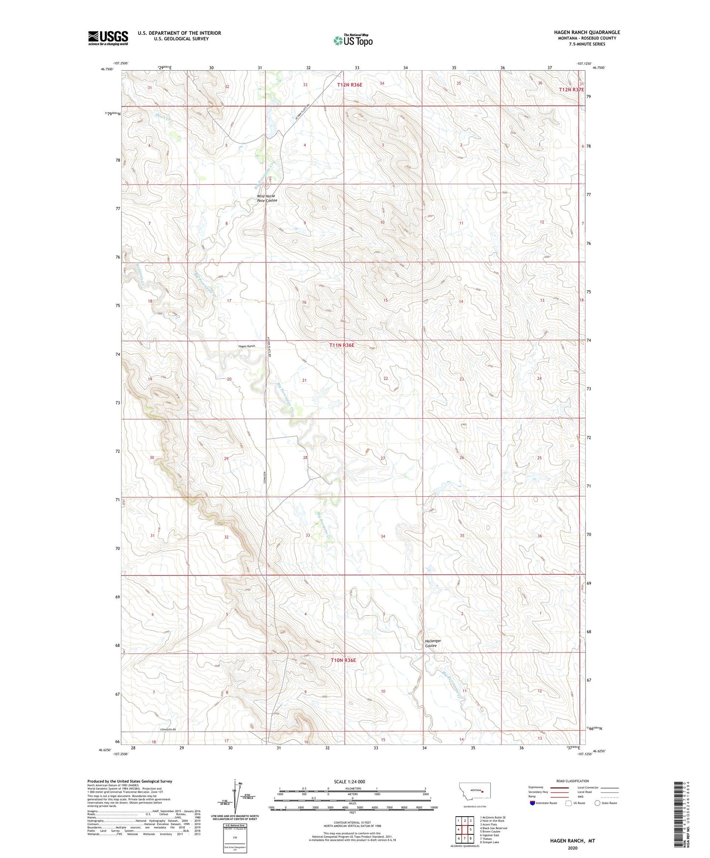
2024 topographic map quadrangle Hagen Ranch in the state of Montana. Scale: 1:24000. Based on the newly updated USGS 7.5' US Topo map series, this map is in the following counties: Rosebud. The map contains contour data, water features, and other items you are used to seeing on USGS maps, but also has updated roads and other features. This is the next generation of topographic maps. Printed on high-quality waterproof paper with UV fade-resistant inks.
Quads adjacent to this one:
West: Black Sea Reservoir
Northwest: McGinnis Butte SE
North: Hole-in-the-Rock
Northeast: Acorn Flats
East: Brown Coulee
Southeast: Zempel Lake
South: Thebes
Southwest: Ingomar East
This map covers the same area as the classic USGS quad with code o46107f2.
Contains the following named places: 10N36E06CA__01 Well, 10N36E06CACA01 Well, 11N36E28BACD01 Well, Cherry Creek Number 1 Dam, Cherry Creek Number 10 Dam, Cherry Creek Number 11 Dam, Cherry Creek Number 2 Dam, Cherry Creek Number 4 Dam, Cherry Creek Number 5 Dam, Cherry Creek Number 6 Dam, Cherry Creek Number 9 Dam, Hagen Ranch, Hallanger Coulee, Ivanell Post Office, Ivanell School, McDonald Ranch, McGinnis Creek, McGinnis School, Mysse Ranch, Schlesinger Number 2 Dam, Schlesinger Number 5 Dam, Schlesinger Number 6 Dam, Schlesinger Number 7 Dam, Schlesinger Ranch, Short Creek, US Number 33 Dam, Wild Horse Pete Coulee