MyTopo
Agawam South Montana US Topo Map
Couldn't load pickup availability
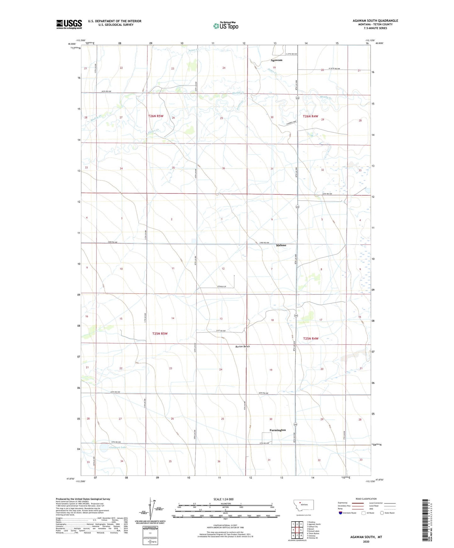
2024 topographic map quadrangle Agawam South in the state of Montana. Scale: 1:24000. Based on the newly updated USGS 7.5' US Topo map series, this map is in the following counties: Teton. The map contains contour data, water features, and other items you are used to seeing on USGS maps, but also has updated roads and other features. This is the next generation of topographic maps. Printed on high-quality waterproof paper with UV fade-resistant inks.
Quads adjacent to this one:
West: Bynum
Northwest: Pendroy
North: Agawam North
Northeast: Gallup City
East: Eyraud Lakes
Southeast: Choteau SE
South: Choteau
Southwest: Teton Buttes
This map covers the same area as the classic USGS quad with code o47112h2.
Contains the following named places: 25N04W06____01 Well, 25N04W06____02 Well, 25N04W06____03 Well, 25N04W06BA__01 Well, 25N04W19D___01 Well, 25N05W24CDDD01 Well, Agawam, Agawam Post Office, Agawam School, Burton Bench, Farmington, Farmington Post Office, Farmington School, Foster Creek, German Lutheran Church, Glendora Lake, Jones Creek, Malone