MyTopo
Eyraud Lakes Montana US Topo Map
Couldn't load pickup availability
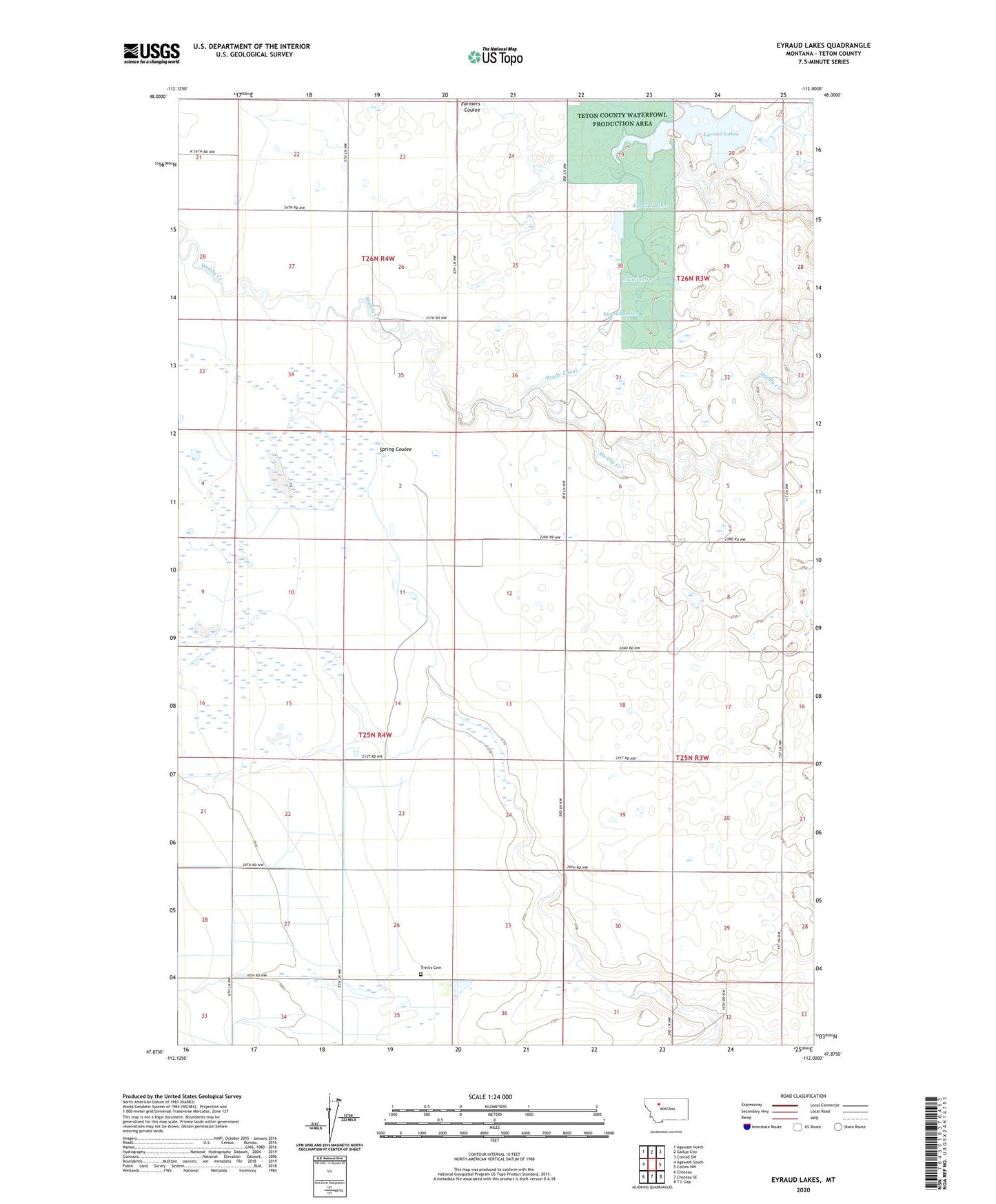
2024 topographic map quadrangle Eyraud Lakes in the state of Montana. Scale: 1:24000. Based on the newly updated USGS 7.5' US Topo map series, this map is in the following counties: Teton. The map contains contour data, water features, and other items you are used to seeing on USGS maps, but also has updated roads and other features. This is the next generation of topographic maps. Printed on high-quality waterproof paper with UV fade-resistant inks.
Quads adjacent to this one:
West: Agawam South
Northwest: Agawam North
North: Gallup City
Northeast: Conrad SW
East: Collins NW
Southeast: T L Gap
South: Choteau SE
Southwest: Choteau
This map covers the same area as the classic USGS quad with code o47112h1.
Contains the following named places: 25N04W02B___01 Well, 25N04W02C___01 Well, 25N04W03____01 Well, 25N04W03____02 Well, 25N04W03____03 Well, 25N04W03____04 Well, 25N04W03____05 Well, 25N04W03____06 Well, 25N04W03____07 Well, 25N04W03D___01 Well, 25N04W03D___02 Well, 25N04W11A___01 Well, 25N04W11C___01 Well, 25N04W11C___02 Well, 25N04W11D___01 Well, 25N04W11D___02 Well, 25N04W23C___01 Well, 25N04W28D___01 Well, 26N04W21D___01 Well, 26N04W23D___01 Well, 26N04W35B___01 Well, 26N04W35C___01 Well, 26N04W36DCDB01 Well, Arod Lake Fishing Access Site, Brady Canal, Brady Lakes Number 4 Dam, Burton, Burton Post Office, East Farmington Number 5 School, Eyraud Lakes, Middle Lake, Round Lake, Teton County Waterfowl Production Area, Trinity Cemetery