MyTopo
Albion Montana US Topo Map
Couldn't load pickup availability
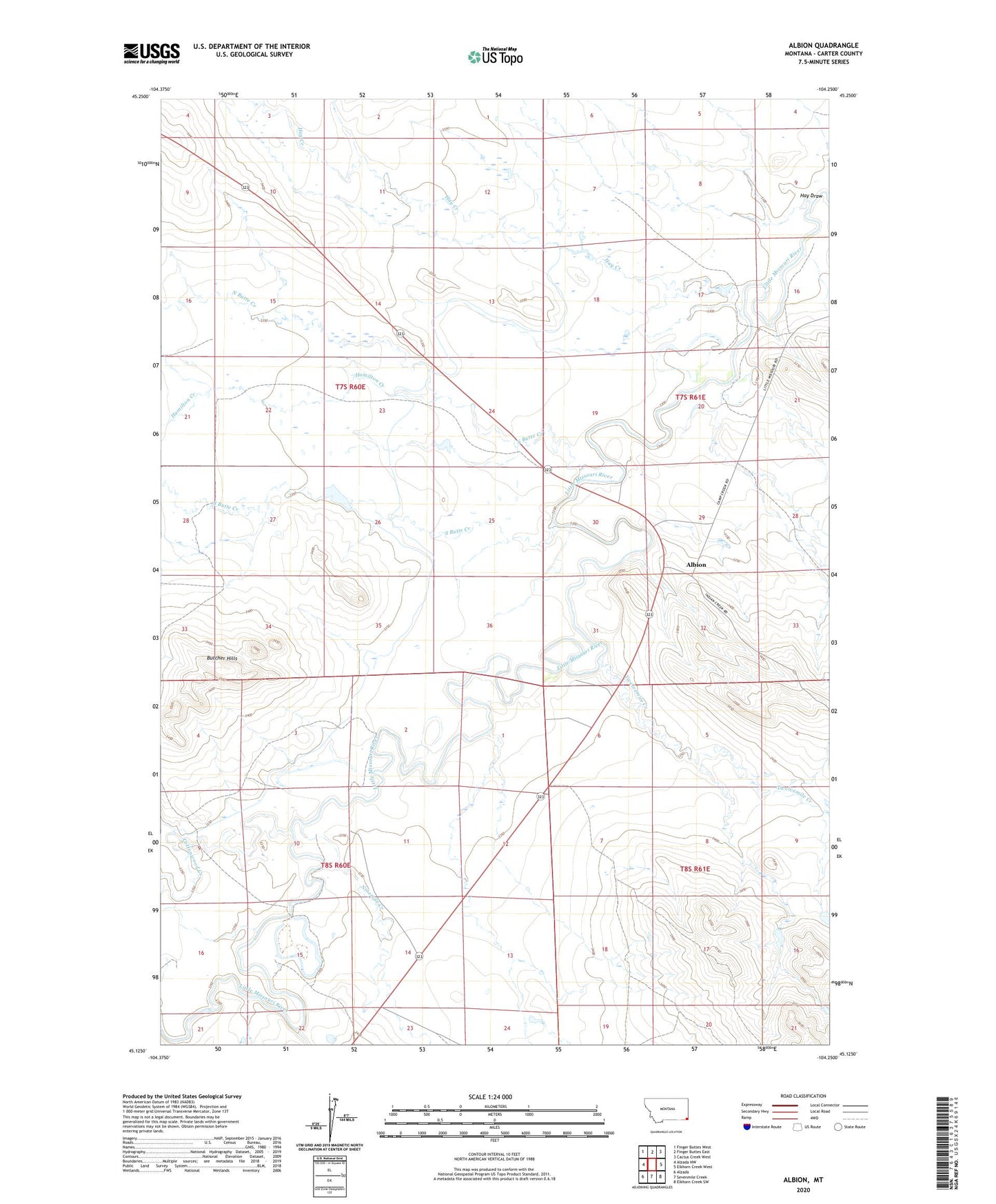
2024 topographic map quadrangle Albion in the state of Montana. Scale: 1:24000. Based on the newly updated USGS 7.5' US Topo map series, this map is in the following counties: Carter. The map contains contour data, water features, and other items you are used to seeing on USGS maps, but also has updated roads and other features. This is the next generation of topographic maps. Printed on high-quality waterproof paper with UV fade-resistant inks.
Quads adjacent to this one:
West: Alzada NW
Northwest: Finger Buttes West
North: Finger Buttes East
Northeast: Cactus Creek West
East: Elkhorn Creek West
Southeast: Elkhorn Creek SW
South: Sevenmile Creek
Southwest: Alzada
This map covers the same area as the classic USGS quad with code o45104b3.
Contains the following named places: 08S60E15CABD01 Well, Albion, Albion Post Office, Albion School, Arbuckle Number 1 Dam, Arbuckle Number 2 Dam, Butcher Hills, Cottonwood Creek, Hamilton Creek, Hay Creek, Hay Draw, Korneman Dam, Ninemile Creek, North Butte Creek, Oliver Number 2 Dam, Rhoades Post Office, South Butte Creek, Twelvemile Creek