MyTopo
Cactus Creek West Montana US Topo Map
Couldn't load pickup availability
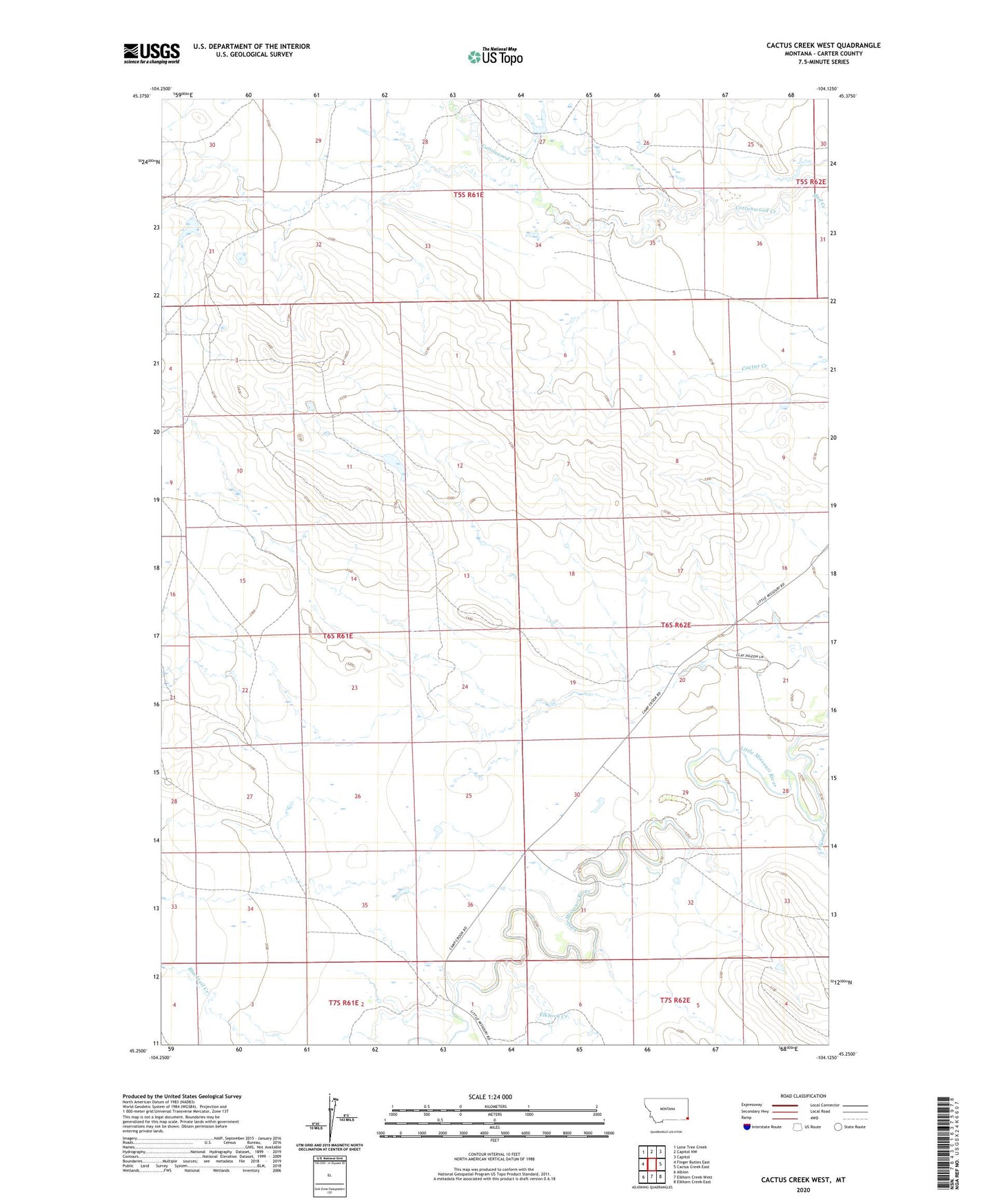
2024 topographic map quadrangle Cactus Creek West in the state of Montana. Scale: 1:24000. Based on the newly updated USGS 7.5' US Topo map series, this map is in the following counties: Carter. The map contains contour data, water features, and other items you are used to seeing on USGS maps, but also has updated roads and other features. This is the next generation of topographic maps. Printed on high-quality waterproof paper with UV fade-resistant inks.
Quads adjacent to this one:
West: Finger Buttes East
Northwest: Lone Tree Creek
North: Capitol NW
Northeast: Capitol
East: Cactus Creek East
Southeast: Elkhorn Creek East
South: Elkhorn Creek West
Southwest: Albion
This map covers the same area as the classic USGS quad with code o45104c2.
Contains the following named places: 06S62E21ACAB01 Well, 07S62E06BCBD01 Well, Elkhorn Creek, Plum Creek