MyTopo
Alkali Coulee Montana US Topo Map
Couldn't load pickup availability
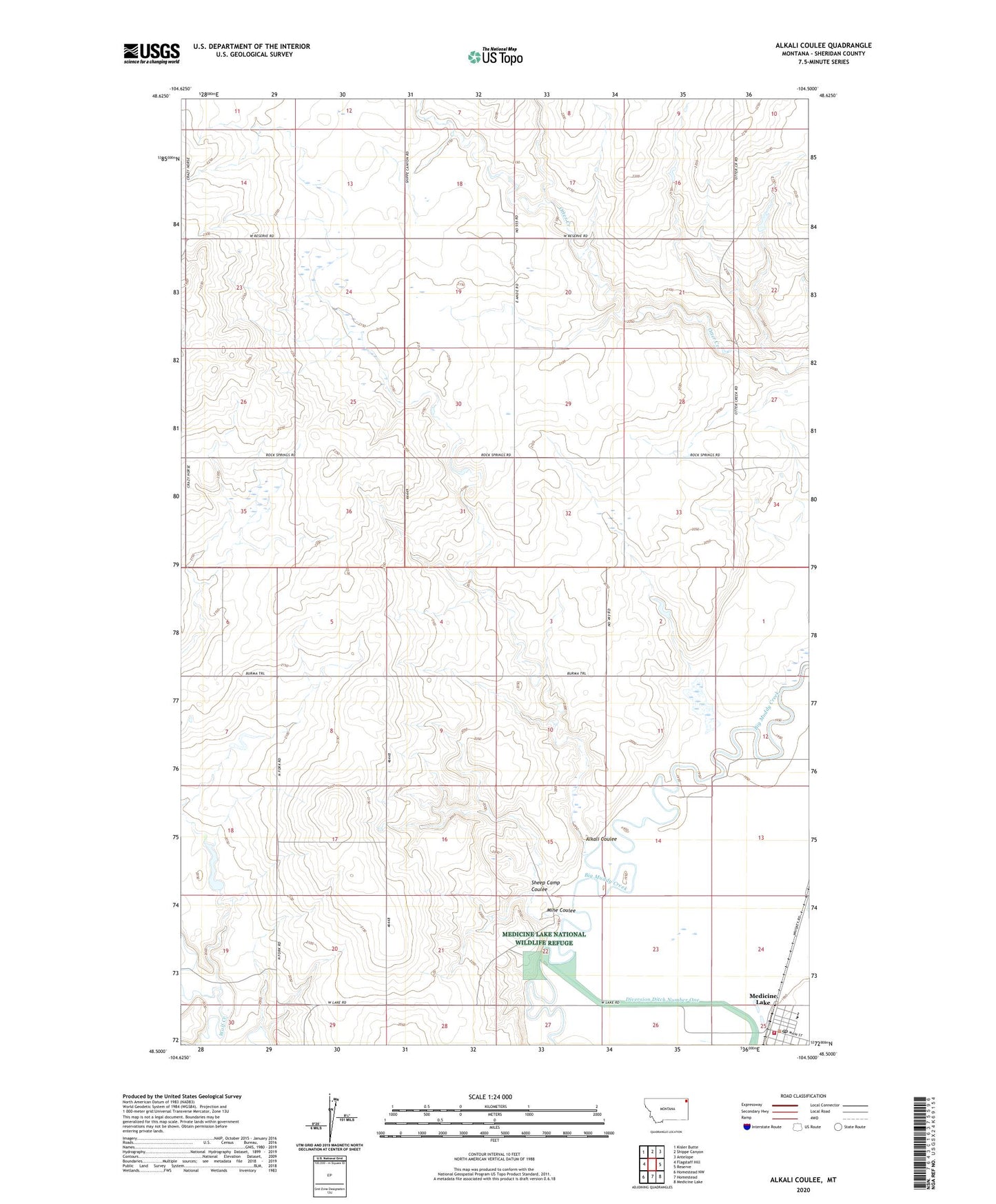
2020 topographic map quadrangle Alkali Coulee in the state of Montana. Scale: 1:24000. Based on the newly updated USGS 7.5' US Topo map series, this map is in the following counties: Sheridan. The map contains contour data, water features, and other items you are used to seeing on USGS maps, but also has updated roads and other features. This is the next generation of topographic maps. Printed on high-quality waterproof paper with UV fade-resistant inks.
Quads adjacent to this one:
West: Flagstaff Hill
Northwest: Kisler Butte
North: Shippe Canyon
Northeast: Antelope
East: Reserve
Southeast: Medicine Lake
South: Homestead
Southwest: Homestead NW
Contains the following named places: 32N55E18ADDD01 Well, 32N55E25ABCB01 Well, 33N54E13CDCC01 Well, 33N55E18DDAA01 Well, 33N55E27BBBA01 Well, 33N56E28DAAD01 Well, 59247, Alkali Coulee, Dam Number 1, Diversion Ditch Number One, Engstrom Dam, Medicine Lake, Medicine Lake Lutheran Church, Medicine Lake Post Office, Medicine Lake School, Medicine Lake Volunteer Fire Department, Mine Coulee, Olson Trading, Rose Valley, Saint Patricks Catholic Church, Sheep Camp Coulee, Town of Medicine Lake, Union Congregational Church