MyTopo
Homestead NW Montana US Topo Map
Couldn't load pickup availability
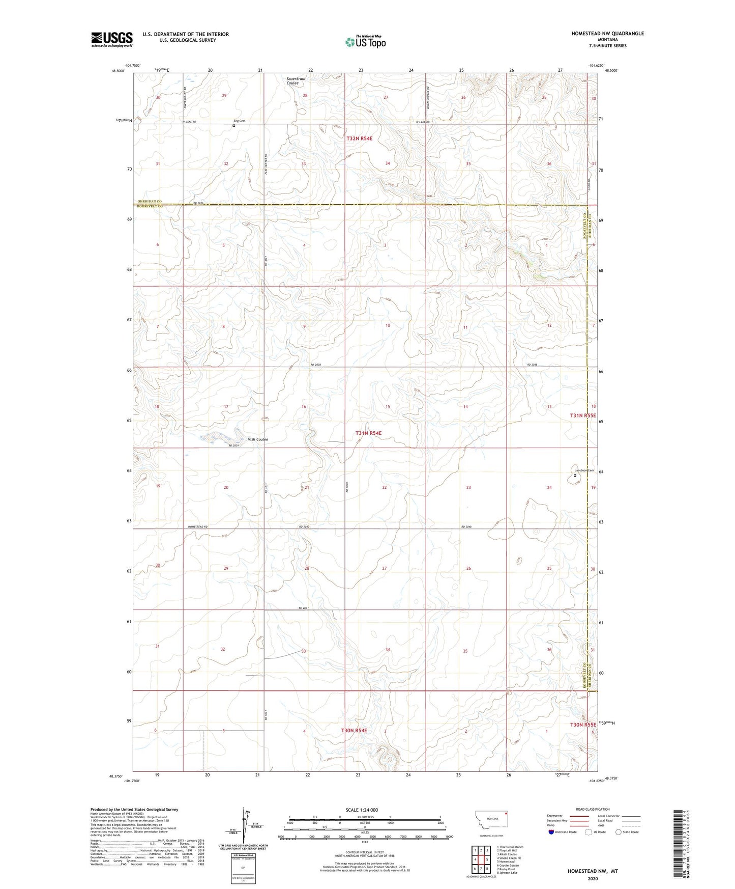
2024 topographic map quadrangle Homestead NW in the state of Montana. Scale: 1:24000. Based on the newly updated USGS 7.5' US Topo map series, this map is in the following counties: Roosevelt, Sheridan. The map contains contour data, water features, and other items you are used to seeing on USGS maps, but also has updated roads and other features. This is the next generation of topographic maps. Printed on high-quality waterproof paper with UV fade-resistant inks.
Quads adjacent to this one:
West: Smoke Creek NE
Northwest: Thornwood Ranch
North: Flagstaff Hill
Northeast: Alkali Coulee
East: Homestead
Southeast: Johnson Lake
South: Rocky Point
Southwest: Coyote Coulee
This map covers the same area as the classic USGS quad with code o48104d6.
Contains the following named places: 31N54E16DCDA01 Well, 31N54E23DDDD01 Well, 31N54E28DCDC01 Well, 31N55E07CBCB01 Well, 32N54E33BABC01 Well, Eng Cemetery, Flat Center School, Fort Kipp District, Jacobson Cemetery, Murray School