MyTopo
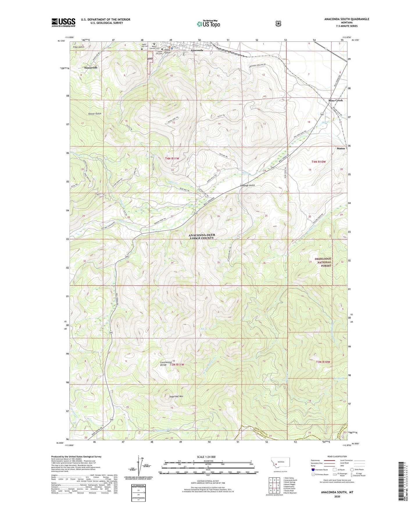
Anaconda South Montana US Topo Map
Couldn't load pickup availability
Also explore the Anaconda South Forest Service Topo of this same quad for updated USFS data
2024 topographic map quadrangle Anaconda South in the state of Montana. Scale: 1:24000. Based on the newly updated USGS 7.5' US Topo map series, this map is in the following counties: Deer Lodge, Silver Bow. The map contains contour data, water features, and other items you are used to seeing on USGS maps, but also has updated roads and other features. This is the next generation of topographic maps. Printed on high-quality waterproof paper with UV fade-resistant inks.
Quads adjacent to this one:
West: Mount Haggin
Northwest: West Valley
North: Anaconda North
Northeast: Warm Springs
East: Opportunity
Southeast: Burnt Mountain
South: Dickie Peak
Southwest: Lincoln Gulch
This map covers the same area as the classic USGS quad with code o46112a8.
Contains the following named places: 04N10W17BB__01 Well, 04N10W18AC__01 Well, 04N10W18DB__01 Well, 04N11W08ADBB01 Well, Alpha Mine, Anaconda - Deer Lodge County Police Department, Anaconda Smelter, Anaconda Smelter Stack State Park, Brick Plant Spur, Cabbage Gulch, Clear Creek, Deer Lodge County Courthouse, Deer Spring, East Anaconda, Elk Creek, First Christian Church, Ironton, KGLM-FM (Anaconda), Long Canyon Creek, Long Canyon Trail, Lower Hill Cemetery, Mill Creek, Mill Creek School, Mine Creek, Moonlight Mine, Mount Carmel Cemetery, Mount Haggin State Wildlife Management Area, Pennsylvania Mine, Sheep Gulch, Silver Creek, Smelter Tailings Ponds Dam, Smelters, Sugarloaf Mountain, Sunnyside, SW SE Section 33 Mine, Upper Hill Cemetery, West Fork Willow Creek