MyTopo
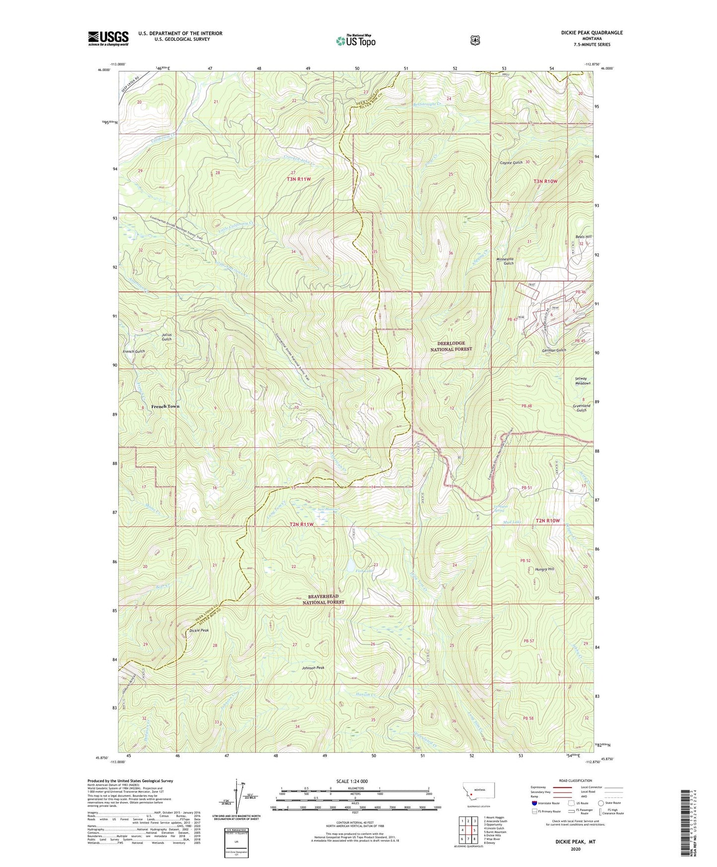
Dickie Peak Montana US Topo Map
Couldn't load pickup availability
Also explore the Dickie Peak Forest Service Topo of this same quad for updated USFS data
2024 topographic map quadrangle Dickie Peak in the state of Montana. Scale: 1:24000. Based on the newly updated USGS 7.5' US Topo map series, this map is in the following counties: Silver Bow, Deer Lodge. The map contains contour data, water features, and other items you are used to seeing on USGS maps, but also has updated roads and other features. This is the next generation of topographic maps. Printed on high-quality waterproof paper with UV fade-resistant inks.
Quads adjacent to this one:
West: Lincoln Gulch
Northwest: Mount Haggin
North: Anaconda South
Northeast: Opportunity
East: Burnt Mountain
Southeast: Dewey
South: Wise River
Southwest: Dickie Hills
This map covers the same area as the classic USGS quad with code o45112h8.
Contains the following named places: Beals Hill, Clear Creek, Coyote Gulch, Crooked John Creek, Dickie Peak, Fish Lake, French Town, Hanson Creek, Hungry Hill, Hungry Hill Mine, Johnson Peak, Julius Gulch, Larkspur Spring, Minnesota Gulch, Mud Lake, New Meadows, Patsy Ann Mine, Pine Dale Cow Cabin, Pine Dale Mine, Selway Meadows, Spring Creek