MyTopo
Antelope Point Montana US Topo Map
Couldn't load pickup availability
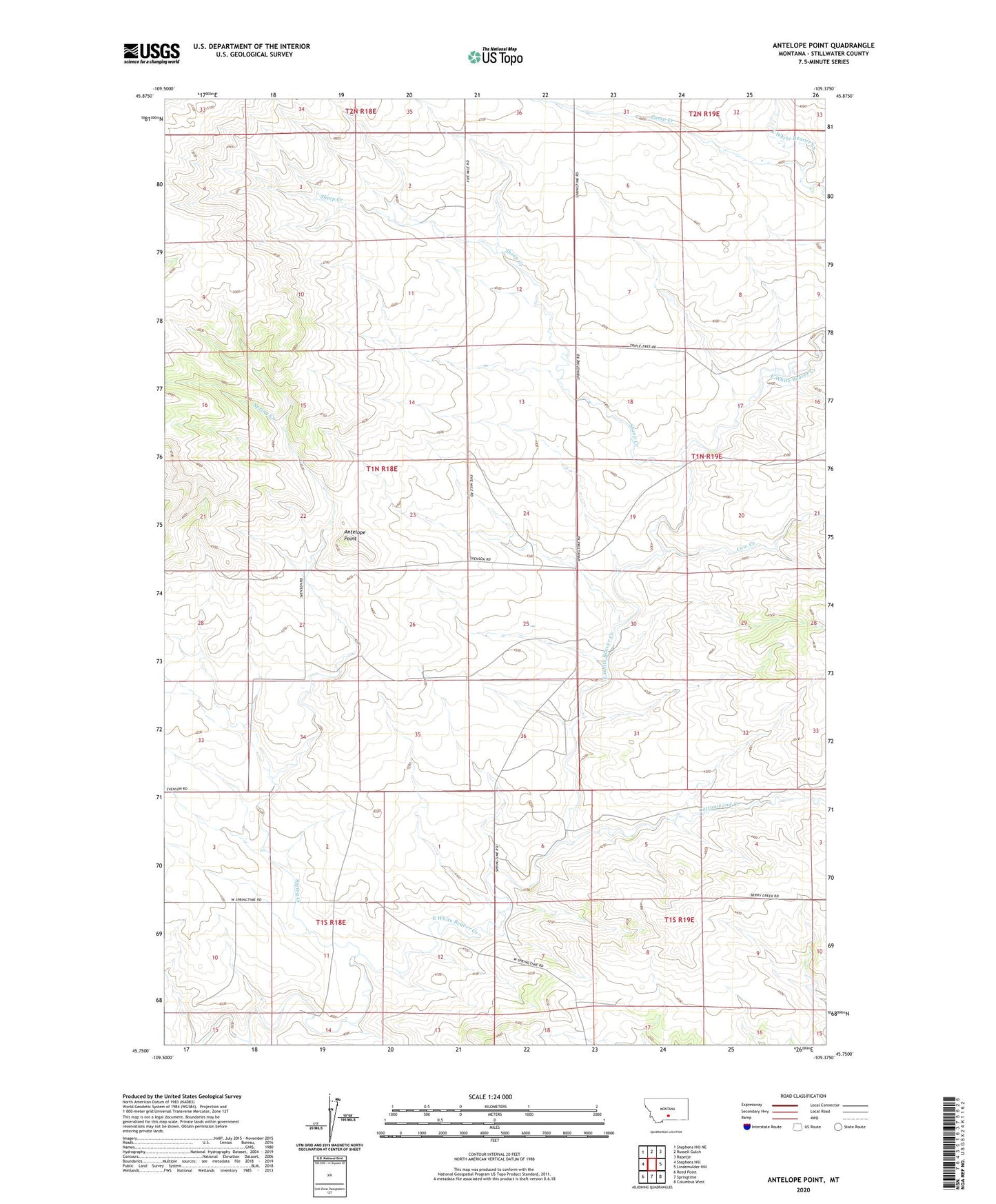
2024 topographic map quadrangle Antelope Point in the state of Montana. Scale: 1:24000. Based on the newly updated USGS 7.5' US Topo map series, this map is in the following counties: Stillwater. The map contains contour data, water features, and other items you are used to seeing on USGS maps, but also has updated roads and other features. This is the next generation of topographic maps. Printed on high-quality waterproof paper with UV fade-resistant inks.
Quads adjacent to this one:
West: Stephens Hill
Northwest: Stephens Hill NE
North: Russell Gulch
Northeast: Rapelje
East: Lindemulder Hill
Southeast: Columbus West
South: Springtime
Southwest: Reed Point
This map covers the same area as the classic USGS quad with code o45109g4.
Contains the following named places: 01N18E22DCCA01 Well, Antelope Point, Antelope Point School, Camp Creek, Cottonwood Creek, Cottonwood School, Cow Creek, Patten School, Sheep Creek, Spring Creek