MyTopo
Reed Point Montana US Topo Map
Couldn't load pickup availability
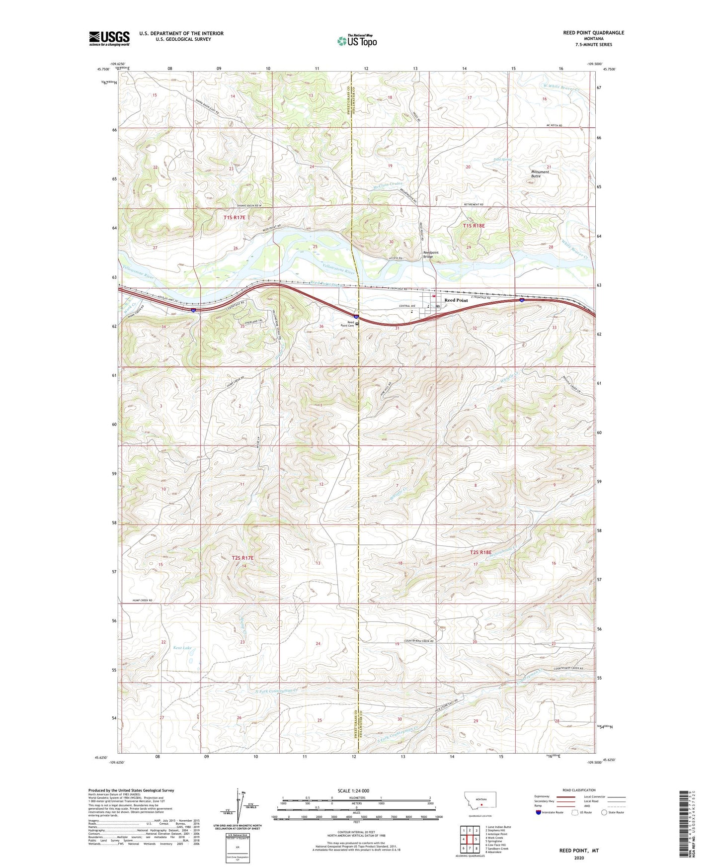
2024 topographic map quadrangle Reed Point in the state of Montana. Scale: 1:24000. Based on the newly updated USGS 7.5' US Topo map series, this map is in the following counties: Stillwater, Sweet Grass. The map contains contour data, water features, and other items you are used to seeing on USGS maps, but also has updated roads and other features. This is the next generation of topographic maps. Printed on high-quality waterproof paper with UV fade-resistant inks.
Quads adjacent to this one:
West: Work Creek
Northwest: Lone Indian Butte
North: Stephens Hill
Northeast: Antelope Point
East: Springtime
Southeast: Absarokee
South: Sandborn Creek
Southwest: Cow Face Hill
This map covers the same area as the classic USGS quad with code o45109f5.
Contains the following named places: 01S17E24BCAA01 Well, 01S17E35ABAB01 Well, 01S17E36AACD01 Well, 01S18E18CCBA01 Well, 01S18E30CCAD01 Well, 01S18E31ADCC01 Well, 01S18E36DCDB01 Well, 02S17E11ADAD01 Well, 02S17E11ADBA01 Well, 02S17E15DCAC01 Spring, 02S17E15DCDC01 Spring, 02S17E22AACB01 Well, Cedar Hills Campground, Dahl Spring, Evangelical Church of North America, Hump Creek, Indian Fort Fishing Access Site, Kent Lake, McClain Coulee, Monument Butte, North Fork Countryman Creek, Reed Point, Reed Point Cemetery, Reed Point Census Designated Place, Reed Point Ditch, Reed Point Elementary School, Reed Point High School, Reed Point Lutheran Congregation, Reed Point Methodist Church, Reed Point Post Office, Reed Point Volunteer Fire Company, Reedpoint Bridge, Saint Josephs Catholic Church, South Fork Countryman Creek, White Beaver Creek, White Beaver School, Work Creek