MyTopo
Hollowwood Creek Montana US Topo Map
Couldn't load pickup availability
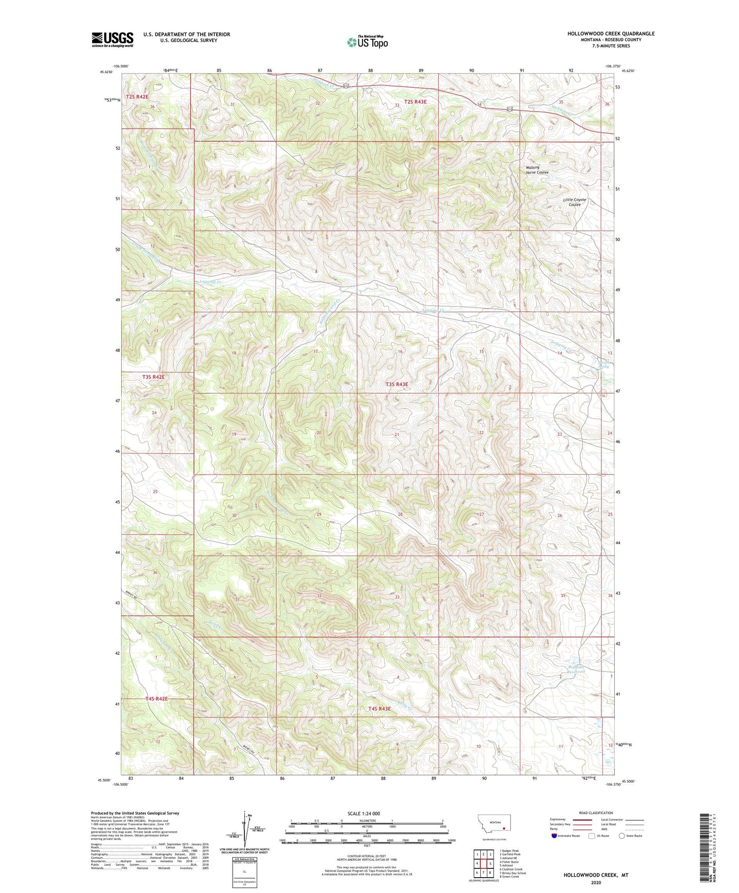
2024 topographic map quadrangle Hollowwood Creek in the state of Montana. Scale: 1:24000. Based on the newly updated USGS 7.5' US Topo map series, this map is in the following counties: Rosebud. The map contains contour data, water features, and other items you are used to seeing on USGS maps, but also has updated roads and other features. This is the next generation of topographic maps. Printed on high-quality waterproof paper with UV fade-resistant inks.
Quads adjacent to this one:
West: Fisher Butte
Northwest: Badger Peak
North: Garfield Peak
Northeast: Ashland NE
East: Ashland
Southeast: Green Creek
South: Birney Day School
Southwest: Clubfoot Creek
This map covers the same area as the classic USGS quad with code o45106e4.
Contains the following named places: 01N42E34AABA01 Well, 03S43E11ABAB01 Well, Bighead Reservoir, Crazy Head Fork, Hollowwood Creek, Patrick Spring, Woodenthigh Creek