MyTopo
Badger Peak Montana US Topo Map
Couldn't load pickup availability
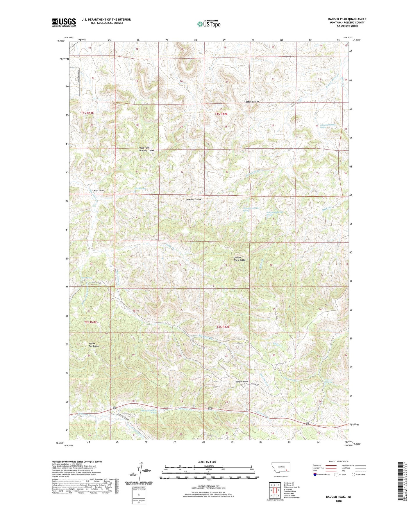
2020 topographic map quadrangle Badger Peak in the state of Montana. Scale: 1:24000. Based on the newly updated USGS 7.5' US Topo map series, this map is in the following counties: Rosebud. The map contains contour data, water features, and other items you are used to seeing on USGS maps, but also has updated roads and other features. This is the next generation of topographic maps. Printed on high-quality waterproof paper with UV fade-resistant inks.
Quads adjacent to this one:
West: Jimtown
Northwest: Colstrip SW
North: Colstrip SE
Northeast: Hammond Draw SW
East: Garfield Peak
Southeast: Hollowwood Creek
South: Fisher Butte
Southwest: Lame Deer
Contains the following named places: 01S42E23CDCA01 Well, 01S42E26DBAB01 Spring, 01S42E26DBDA01 Well, 01S42E27CBBC01 Well, 01S42E34AADA01 Well, 01S42E35CBBC01 Well, 02S41E12ABD_01 Well, 02S42E01BBBC01 Well, 02S42E02BDCA01 Well, 02S42E03BDCD01 Spring, 02S42E04ADCB01 Spring, 02S42E18BCA_01 Well, 02S42E27ABA_01 Well, 02S42E30CBA_01 Well, 02S42E30CCB_01 Well, 08S42E21AAAC01 Spring, Badger Peak, Charlie Black Butte, Diamond R Spring, Kelly Creek, Mud Draw, Mud Springs, South Fork Alderson Creek, West Fork Miller Creek, West Fork Ryegrass Creek, Wood Spring