MyTopo
Ball Coulee Montana US Topo Map
Couldn't load pickup availability
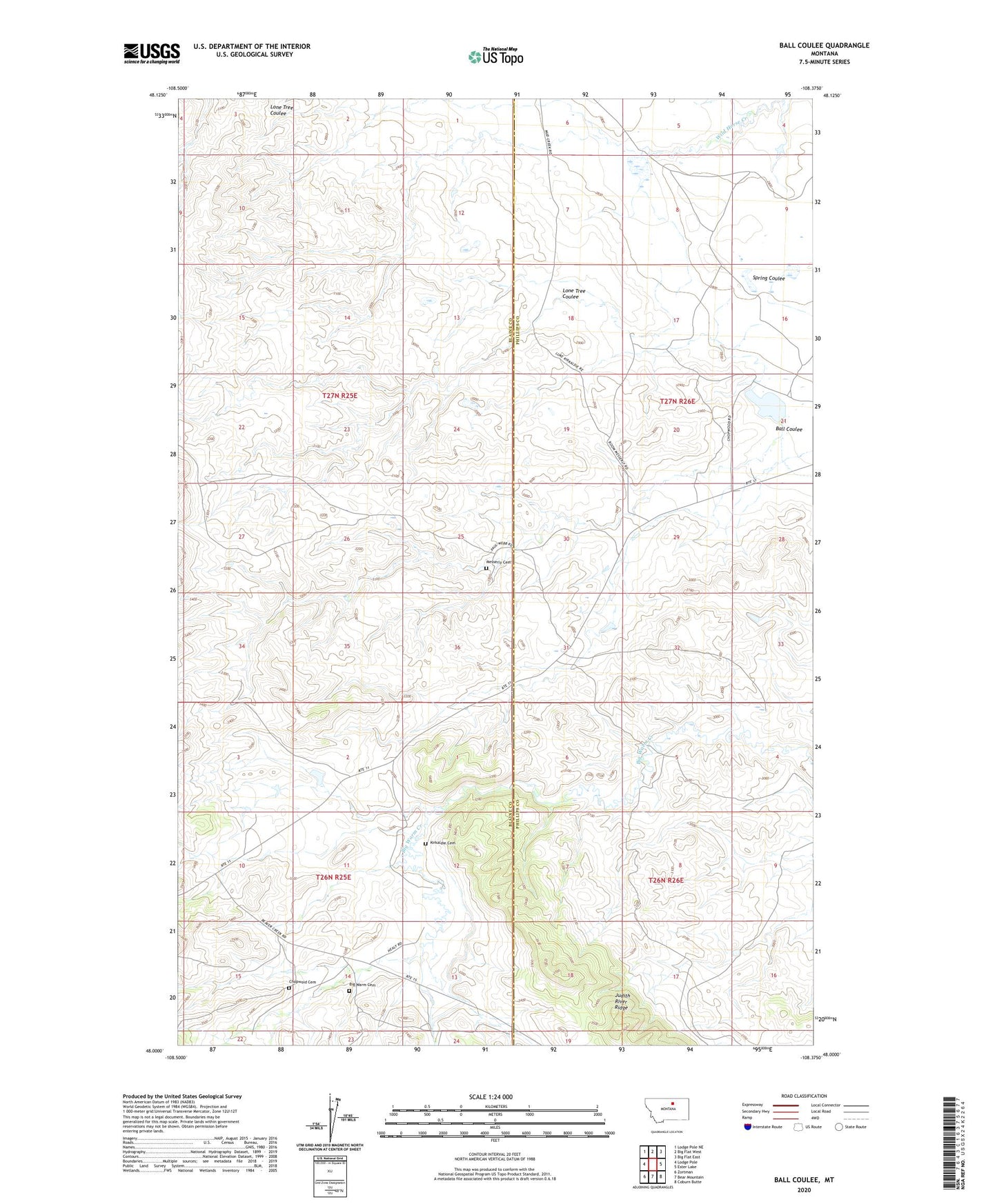
2024 topographic map quadrangle Ball Coulee in the state of Montana. Scale: 1:24000. Based on the newly updated USGS 7.5' US Topo map series, this map is in the following counties: Phillips, Blaine. The map contains contour data, water features, and other items you are used to seeing on USGS maps, but also has updated roads and other features. This is the next generation of topographic maps. Printed on high-quality waterproof paper with UV fade-resistant inks.
Quads adjacent to this one:
West: Lodge Pole
Northwest: Lodge Pole NE
North: Big Flat West
Northeast: Big Flat East
East: Ester Lake
Southeast: Coburn Butte
South: Bear Mountain
Southwest: Zortman
This map covers the same area as the classic USGS quad with code o48108a4.
Contains the following named places: 26N25E01ACAB01 Well, 26N25E11CAC_01 Well, 26N25E12CAC_01 Well, 26N25E12CDC_01 Well, 26N25E13BBA_01 Well, 27N25E25DACC01 Well, 27N25E25DADB01 Well, 27N26E17CBCB01 Well, 27N26E17CBCD01 Well, 27N26E18CBAB01 Well, 27N26E21ACB_01 Well, 27N26E29BCAC01 Well, 27N26E29BCBB01 Well, Ball Coulee, Big Warm, Big Warm Cemetery, Big Warm School, Chopwoid Cemetery, Fort Belknap Number 6 Dam, Fort Belknap Number 7 Dam, Fort Belknap Number 8 Dam, Government Field Reservoir, Government Field Reservoir Dam, Judith River Ridge, Kirkaldie Cemetery, Lodge Pole District, Lone Tree Coulee, Messerly Cemetery