MyTopo
Big Flat West Montana US Topo Map
Couldn't load pickup availability
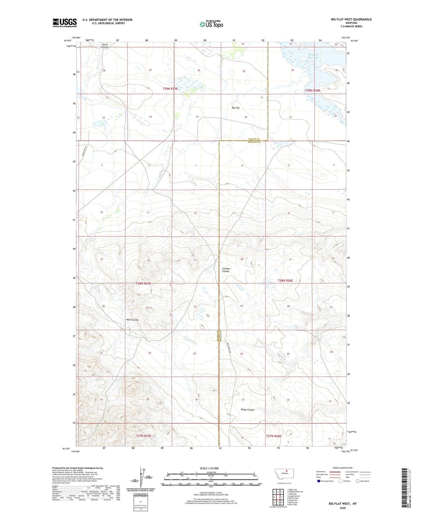
2024 topographic map quadrangle Big Flat West in the state of Montana. Scale: 1:24000. Based on the newly updated USGS 7.5' US Topo map series, this map is in the following counties: Blaine, Phillips. The map contains contour data, water features, and other items you are used to seeing on USGS maps, but also has updated roads and other features. This is the next generation of topographic maps. Printed on high-quality waterproof paper with UV fade-resistant inks.
Quads adjacent to this one:
West: Lodge Pole NE
Northwest: Bigby Lake
North: Weigand Reservoir
Northeast: Coburg SE
East: Big Flat East
Southeast: Ester Lake
South: Ball Coulee
Southwest: Lodge Pole
This map covers the same area as the classic USGS quad with code o48108b4.
Contains the following named places: Allen Coulee, Fort Belknap Number 12 Dam, Fort Belknap Number 14 Dam, Fort Belknap Number 16 Dam, Fort Belknap Reservation Division, Kirkaldie School, Weigand Reservoir, Wolf Coulee