MyTopo
Ester Lake Montana US Topo Map
Couldn't load pickup availability
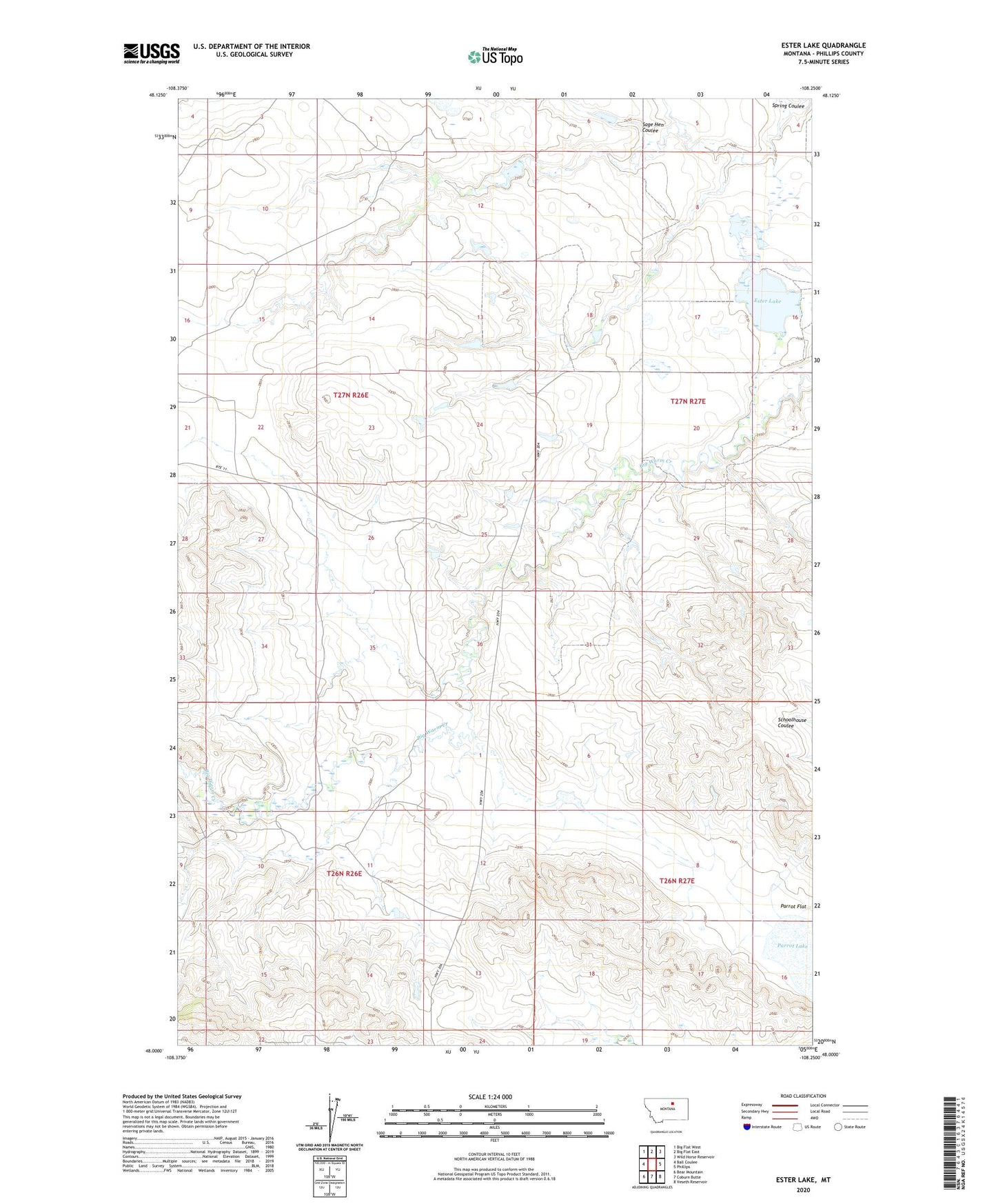
2024 topographic map quadrangle Ester Lake in the state of Montana. Scale: 1:24000. Based on the newly updated USGS 7.5' US Topo map series, this map is in the following counties: Phillips. The map contains contour data, water features, and other items you are used to seeing on USGS maps, but also has updated roads and other features. This is the next generation of topographic maps. Printed on high-quality waterproof paper with UV fade-resistant inks.
Quads adjacent to this one:
West: Ball Coulee
Northwest: Big Flat West
North: Big Flat East
Northeast: Wild Horse Reservoir
East: Phillips
Southeast: Veseth Reservoir
South: Coburn Butte
Southwest: Bear Mountain
This map covers the same area as the classic USGS quad with code o48108a3.
Contains the following named places: 26N26E02DC__01 Well, 27N26E22BCA_01 Well, 27N27E07CDAB01 Well, 27N27E08CAAC01 Well, Brookside, Brookside Post Office, Early Bird Dam, Ester Lake, Ester Lake Dam, Ester Lake School, Ester Reservoir Fishing Access Site, Parrot Flat, Parrot Lake, PR-16 Dam, Sage Hen Coulee, T-Bar Dam, T-Bird Dam