MyTopo
Bar V Ranch NE Montana US Topo Map
Couldn't load pickup availability
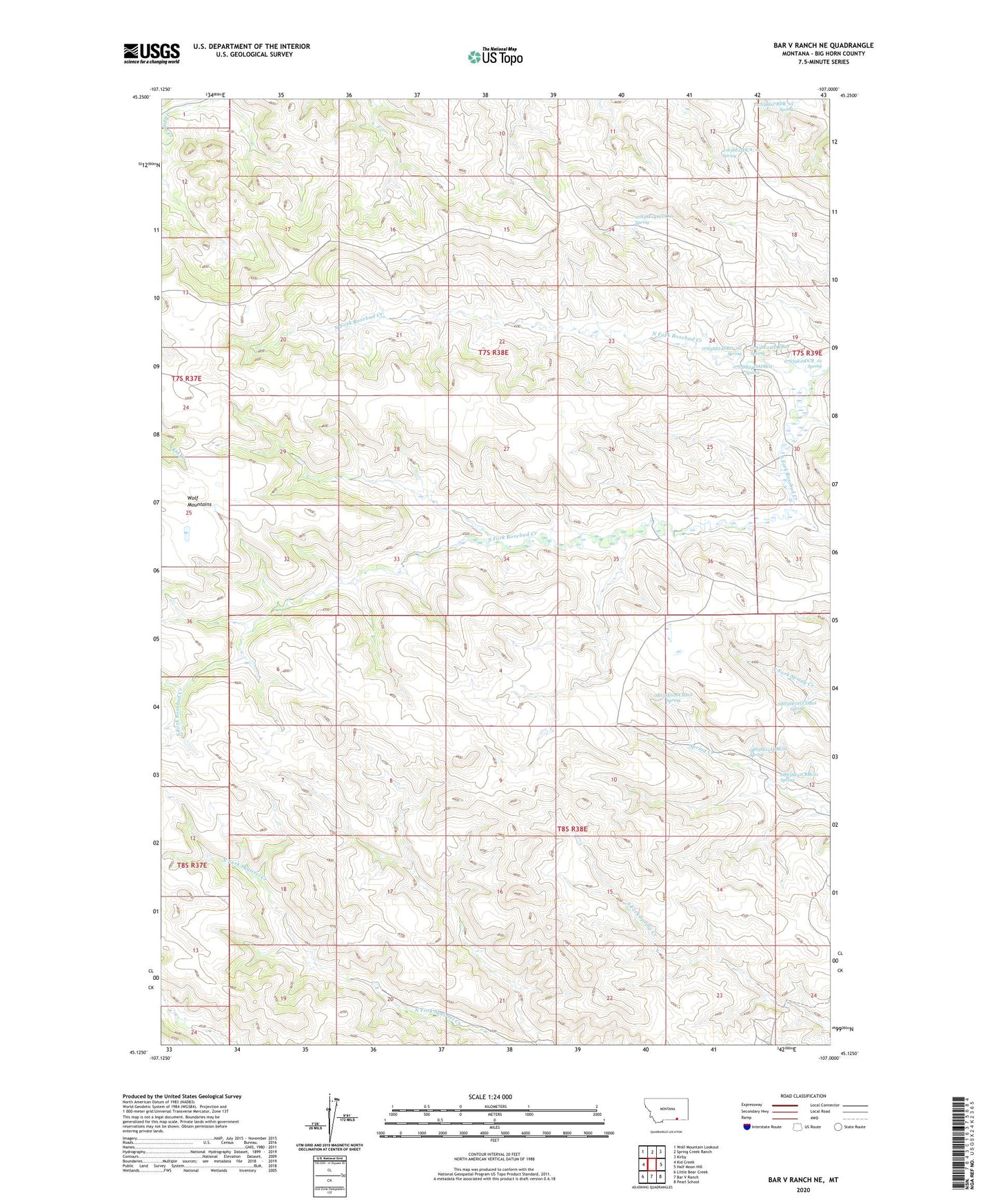
2020 topographic map quadrangle Bar V Ranch NE in the state of Montana. Scale: 1:24000. Based on the newly updated USGS 7.5' US Topo map series, this map is in the following counties: Big Horn. The map contains contour data, water features, and other items you are used to seeing on USGS maps, but also has updated roads and other features. This is the next generation of topographic maps. Printed on high-quality waterproof paper with UV fade-resistant inks.
Quads adjacent to this one:
West: Kid Creek
Northwest: Wolf Mountain Lookout
North: Spring Creek Ranch
Northeast: Kirby
East: Half Moon Hill
Southeast: Pearl School
South: Bar V Ranch
Southwest: Little Bear Creek
Contains the following named places: 07S38E12DCA_01 Spring, 07S38E14ACDD01 Spring, 07S38E24DADB01 Spring, 07S38E24DADB02 Spring, 07S38E24DBD_01 Well, 07S38E24DBD_02 Spring, 07S39E07BDB_01 Spring, 07S39E19CAD_01 Well, 07S39E19CBD_01 Well, 07S39E19DCB_01 Spring, 07S39E31ABBB01 Well, 08S38E01CCDB01 Spring, 08S38E02CCBA01 Spring, 08S38E11ADBC01 Spring, 08S38E11ADBD01 Well, 08S38E12CBBC01 Spring, 08S38E17DADD01 Well, 08S38E17DADD02 Well, North Fork Rosebud Creek, South Fork Rosebud Creek