MyTopo
Bar V Ranch Montana US Topo Map
Couldn't load pickup availability
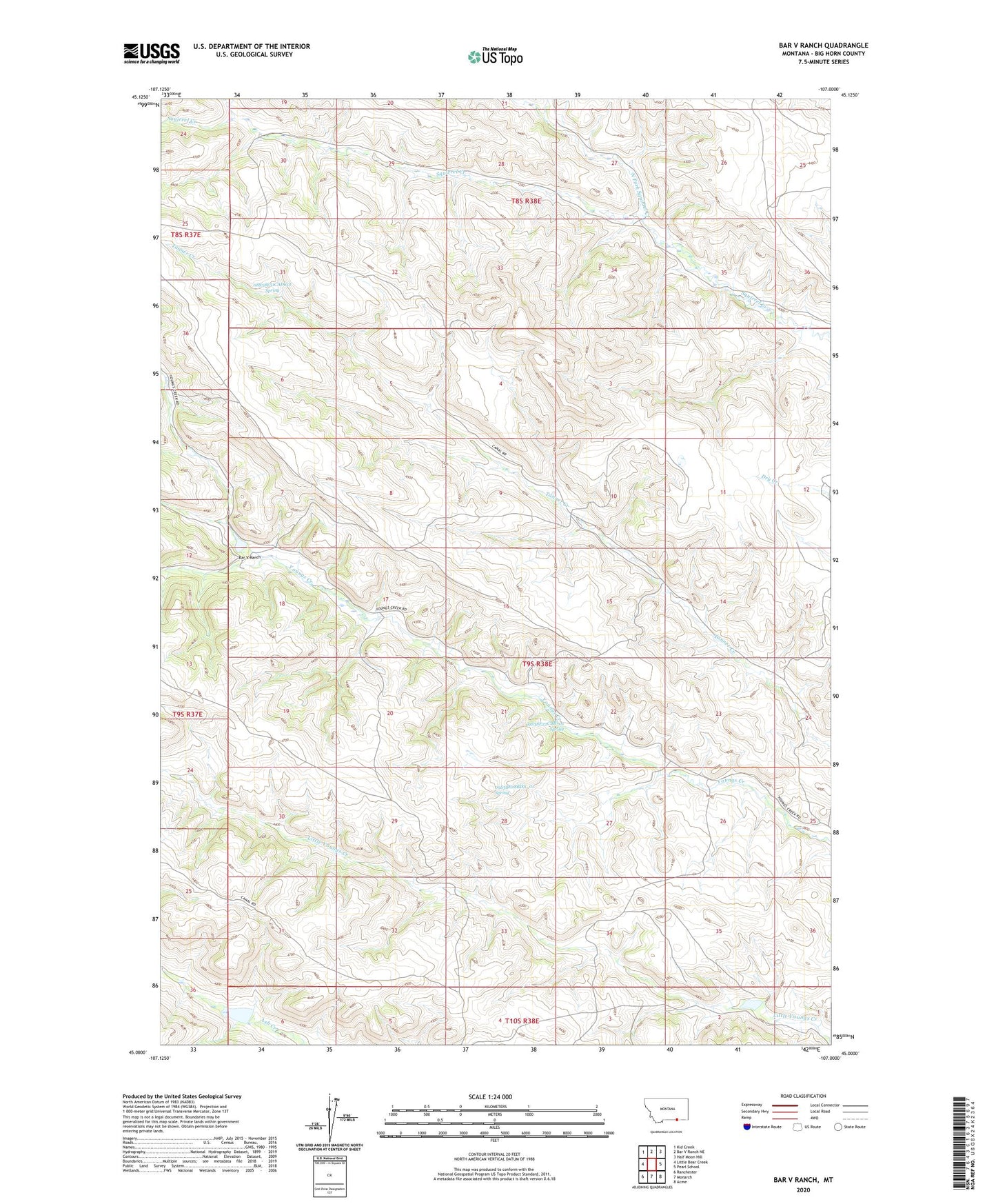
2024 topographic map quadrangle Bar V Ranch in the state of Montana. Scale: 1:24000. Based on the newly updated USGS 7.5' US Topo map series, this map is in the following counties: Big Horn. The map contains contour data, water features, and other items you are used to seeing on USGS maps, but also has updated roads and other features. This is the next generation of topographic maps. Printed on high-quality waterproof paper with UV fade-resistant inks.
Quads adjacent to this one:
West: Little Bear Creek
Northwest: Kid Creek
North: Bar V Ranch NE
Northeast: Half Moon Hill
East: Pearl School
Southeast: Acme
South: Monarch
Southwest: Ranchester
This map covers the same area as the classic USGS quad with code o45107a1.
Contains the following named places: 08S38E28DADB01 Well, 08S38E28DADB02 Well, 08S38E31CADC01 Spring, 09S38E07DADB01 Well, 09S38E10CCAA01 Well, 09S38E10CCAA02 Well, 09S38E22CBB_01 Spring, 09S38E22DADA01 Well, 09S38E22DADC01 Well, 09S38E23CDAD01 Well, 09S38E23CDDA01 Well, 09S38E24BBBC01 Well, 09S38E24BCAC01 Well, 09S38E24CABC01 Well, 09S38E24CABC02 Well, 09S38E25BCBA01 Well, 09S38E25CBDC01 Well, 09S38E26ABAB01 Well, 09S38E27ACBB01 Well, 09S38E27ACBB02 Well, 09S38E28BDA_01 Spring, 09S38E35AABD01 Well, 10S38E01CADD01 Well, Bar V Number 1 Dam, Bar V Ranch, Crow Number 71 Dam, Crow Number 72 Dam, North Fork Squirrel Creek, Pearl Post Office, Weltner School