MyTopo
Kid Creek Montana US Topo Map
Couldn't load pickup availability
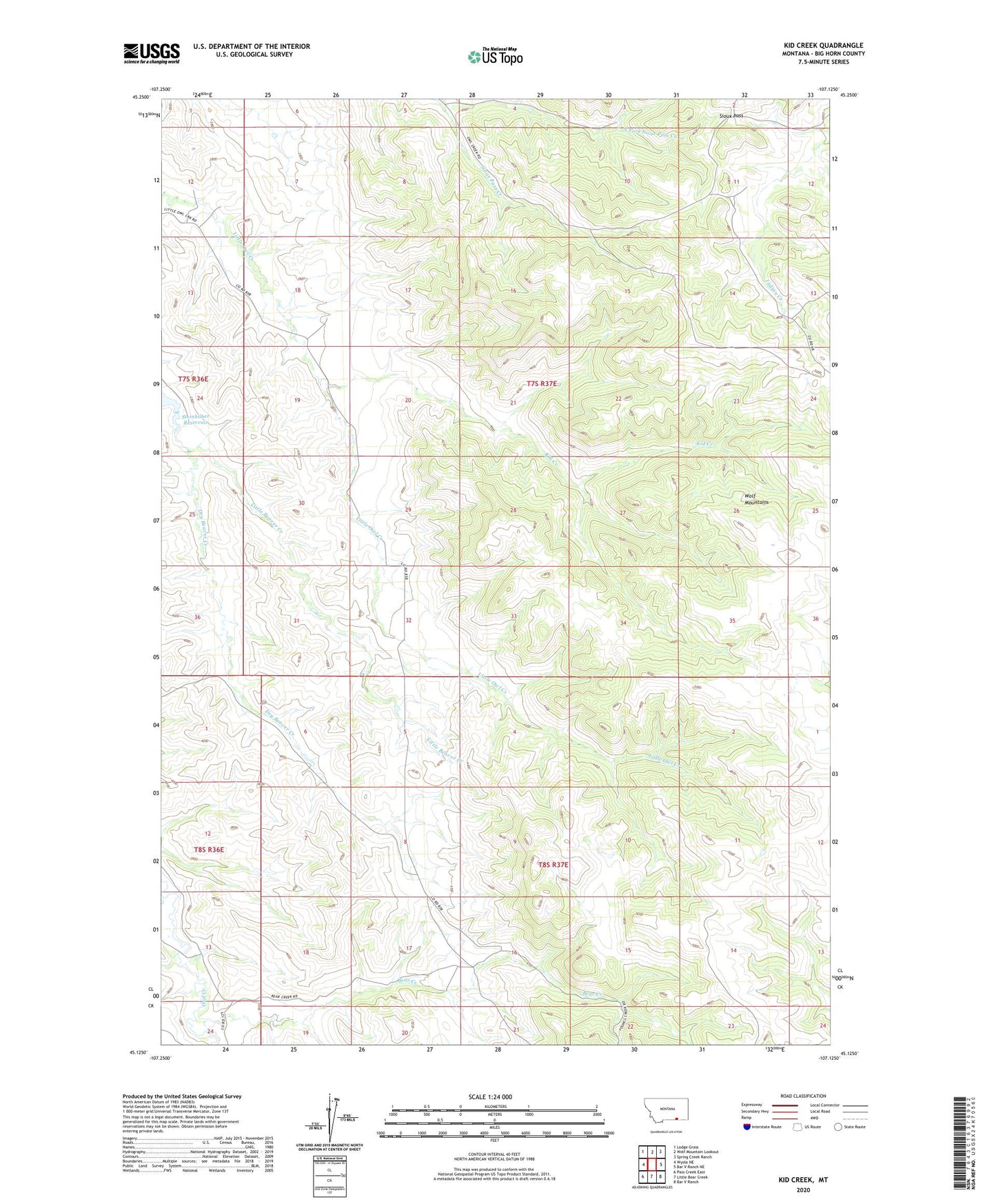
2024 topographic map quadrangle Kid Creek in the state of Montana. Scale: 1:24000. Based on the newly updated USGS 7.5' US Topo map series, this map is in the following counties: Big Horn. The map contains contour data, water features, and other items you are used to seeing on USGS maps, but also has updated roads and other features. This is the next generation of topographic maps. Printed on high-quality waterproof paper with UV fade-resistant inks.
Quads adjacent to this one:
West: Wyola NE
Northwest: Lodge Grass
North: Wolf Mountain Lookout
Northeast: Spring Creek Ranch
East: Bar V Ranch NE
Southeast: Bar V Ranch
South: Little Bear Creek
Southwest: Pass Creek East
This map covers the same area as the classic USGS quad with code o45107b2.
Contains the following named places: 01N37E19DABB01 Well, Bear Creek, Harris School, Kid Creek, Little Bear Creek, Little Beaver Creek, Middle Pine Creek, Millers Ranch, North Fork Sioux Pass Creek, Sioux Pass, Wolf Mountains