MyTopo
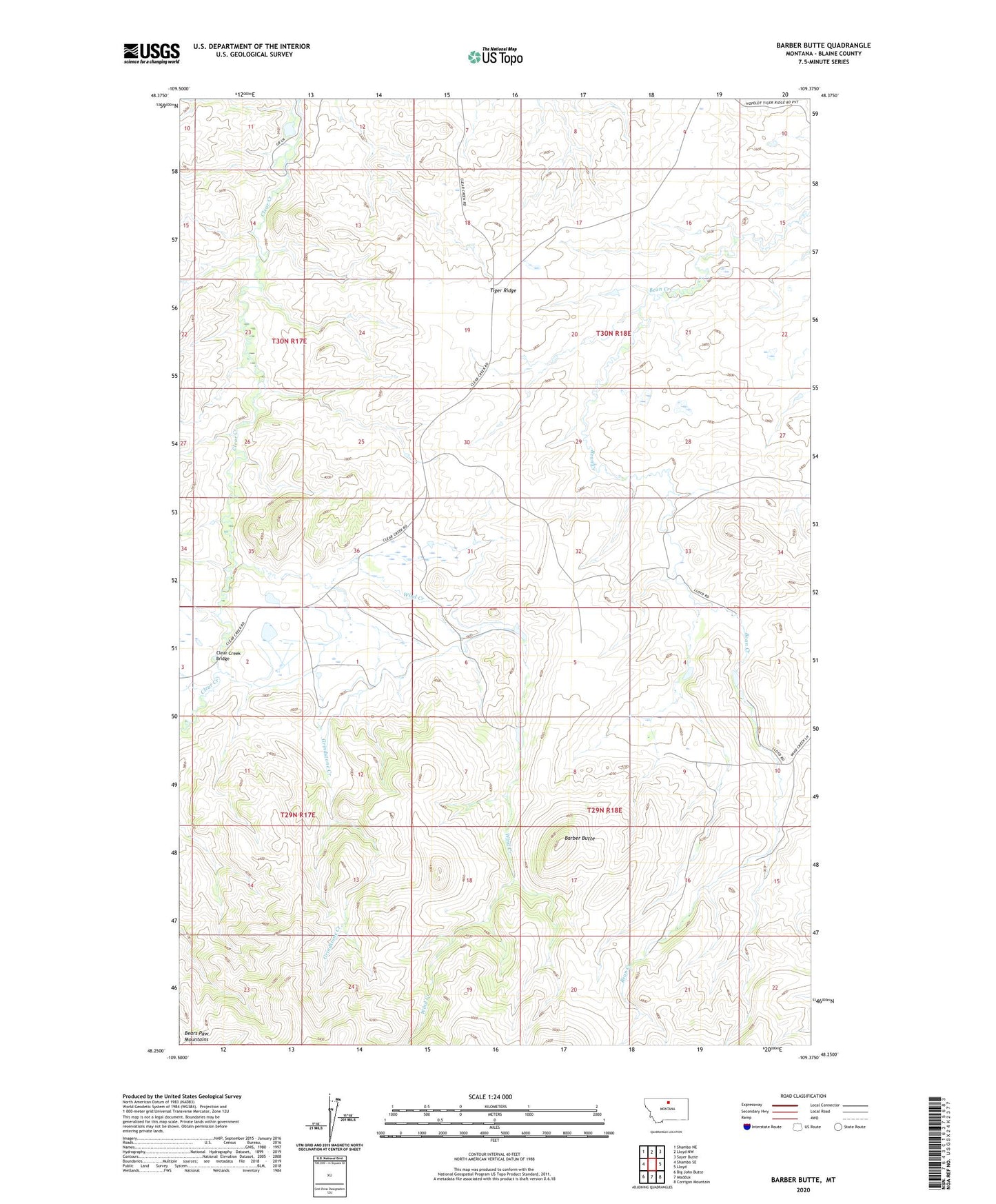
Barber Butte Montana US Topo Map
Couldn't load pickup availability
2024 topographic map quadrangle Barber Butte in the state of Montana. Scale: 1:24000. Based on the newly updated USGS 7.5' US Topo map series, this map is in the following counties: Blaine. The map contains contour data, water features, and other items you are used to seeing on USGS maps, but also has updated roads and other features. This is the next generation of topographic maps. Printed on high-quality waterproof paper with UV fade-resistant inks.
Quads adjacent to this one:
West: Shambo SE
Northwest: Shambo NE
North: Lloyd NW
Northeast: Sayer Butte
East: Lloyd
Southeast: Corrigan Mountain
South: Maddux
Southwest: Big John Butte
This map covers the same area as the classic USGS quad with code o48109c4.
Contains the following named places: Barber Butte, Carasco Post Office, Clear Creek Bridge, Clear Creek School, Clearcreek Post Office, Diamond Bar School, Grindstone Creek, Wind Creek