MyTopo
Lloyd NW Montana US Topo Map
Couldn't load pickup availability
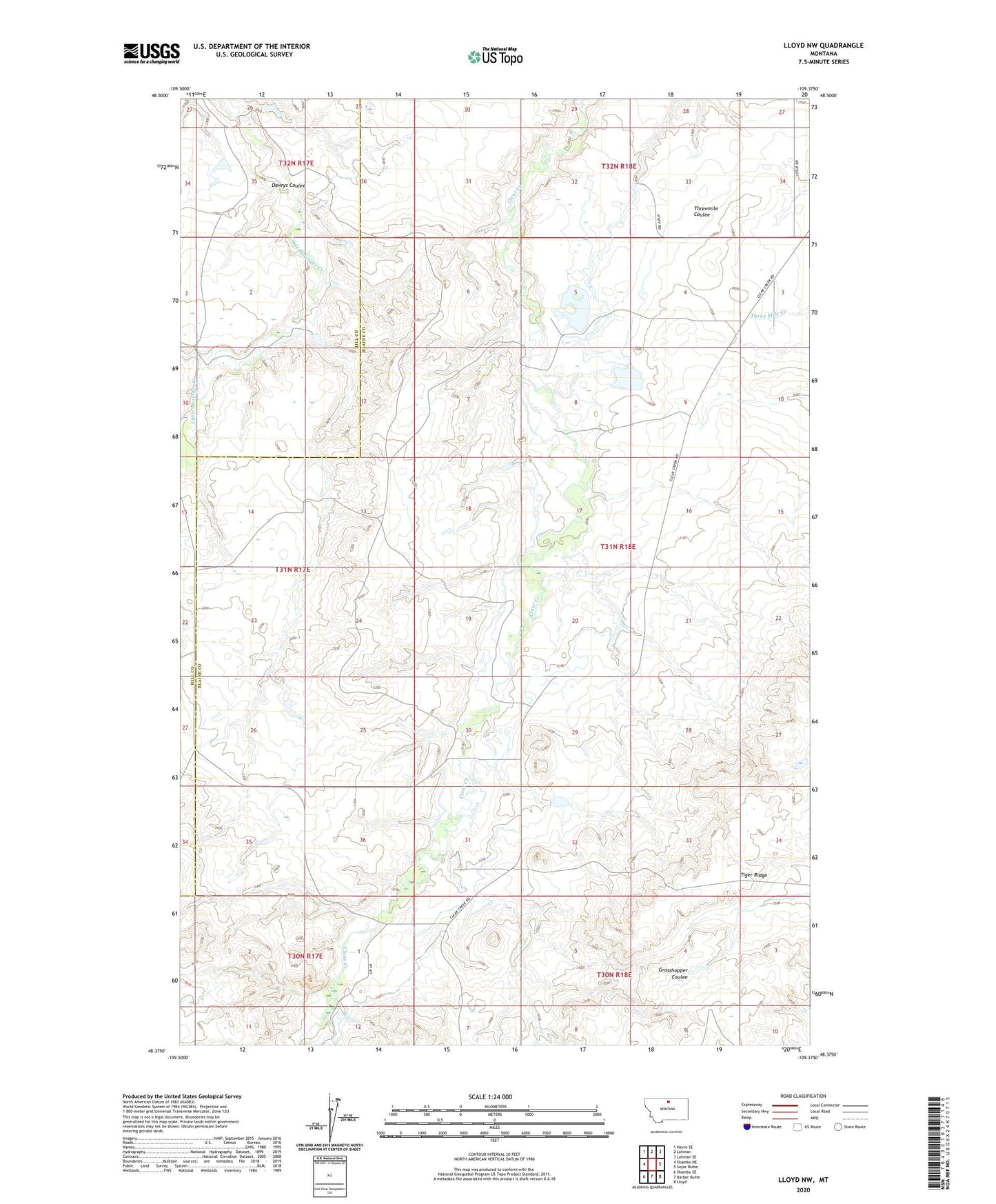
2024 topographic map quadrangle Lloyd NW in the state of Montana. Scale: 1:24000. Based on the newly updated USGS 7.5' US Topo map series, this map is in the following counties: Blaine, Hill. The map contains contour data, water features, and other items you are used to seeing on USGS maps, but also has updated roads and other features. This is the next generation of topographic maps. Printed on high-quality waterproof paper with UV fade-resistant inks.
Quads adjacent to this one:
West: Shambo NE
Northwest: Havre SE
North: Lohman
Northeast: Lohman SE
East: Sayer Butte
Southeast: Lloyd
South: Barber Butte
Southwest: Shambo SE
This map covers the same area as the classic USGS quad with code o48109d4.
Contains the following named places: 31N18E21BABB01 Well, 31N18E21BACA01 Well, Ada Post Office, Ada School, Box Office Dam, Daveys Coulee, Logie School, Sprague School, Staff Number 1 Dam, Staff Number 2 Dam, Staff Reservoir, Tiger Ridge