MyTopo
Buffalo Hill Montana US Topo Map
Couldn't load pickup availability
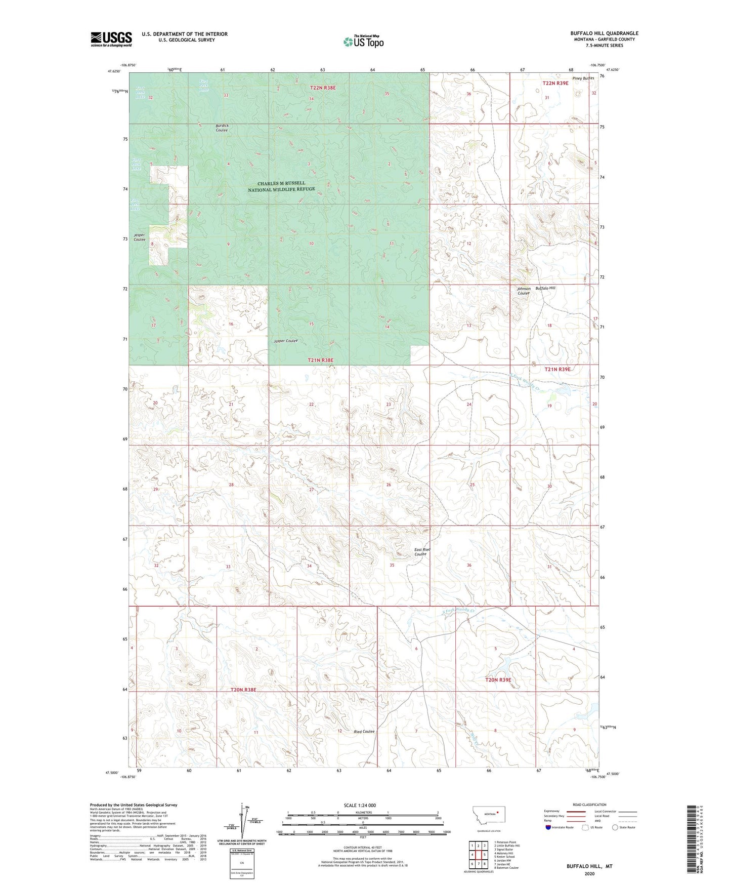
2024 topographic map quadrangle Buffalo Hill in the state of Montana. Scale: 1:24000. Based on the newly updated USGS 7.5' US Topo map series, this map is in the following counties: Garfield. The map contains contour data, water features, and other items you are used to seeing on USGS maps, but also has updated roads and other features. This is the next generation of topographic maps. Printed on high-quality waterproof paper with UV fade-resistant inks.
Quads adjacent to this one:
West: Maloney Hill
Northwest: Peterson Point
North: Little Buffalo Hill
Northeast: Signal Butte
East: Kester School
Southeast: Bateman Coulee
South: Jordan NE
Southwest: Jordan NW
This map covers the same area as the classic USGS quad with code o47106e7.
Contains the following named places: 21N38E24A___01 Well, 21N39E19B___01 Well, Big Bucks Number 16 Dam, Buffalo Hill, Burdick Coulee, Claribell Number 4 Dam, Jensen Dam