MyTopo
Battle Butte Montana US Topo Map
Couldn't load pickup availability
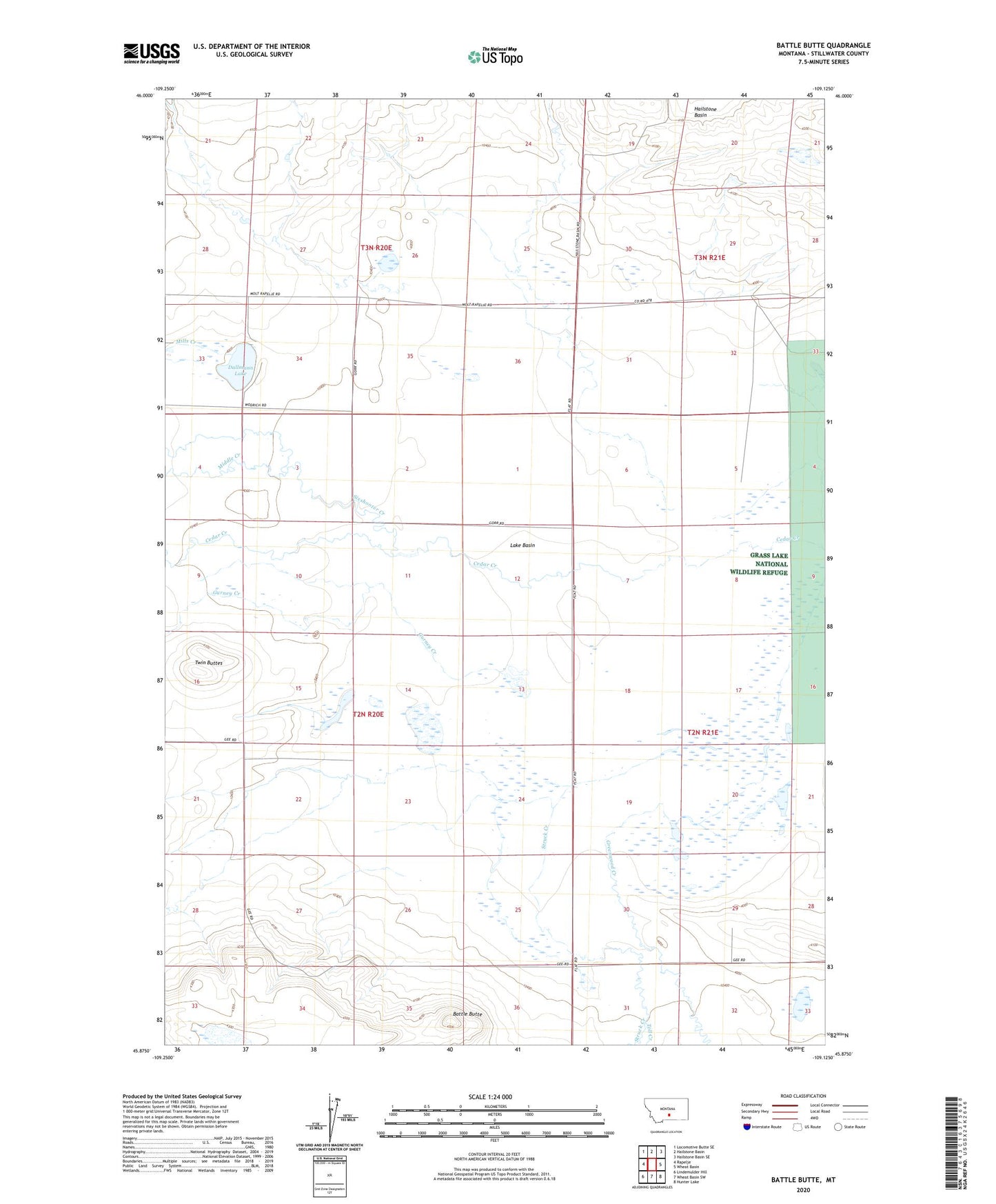
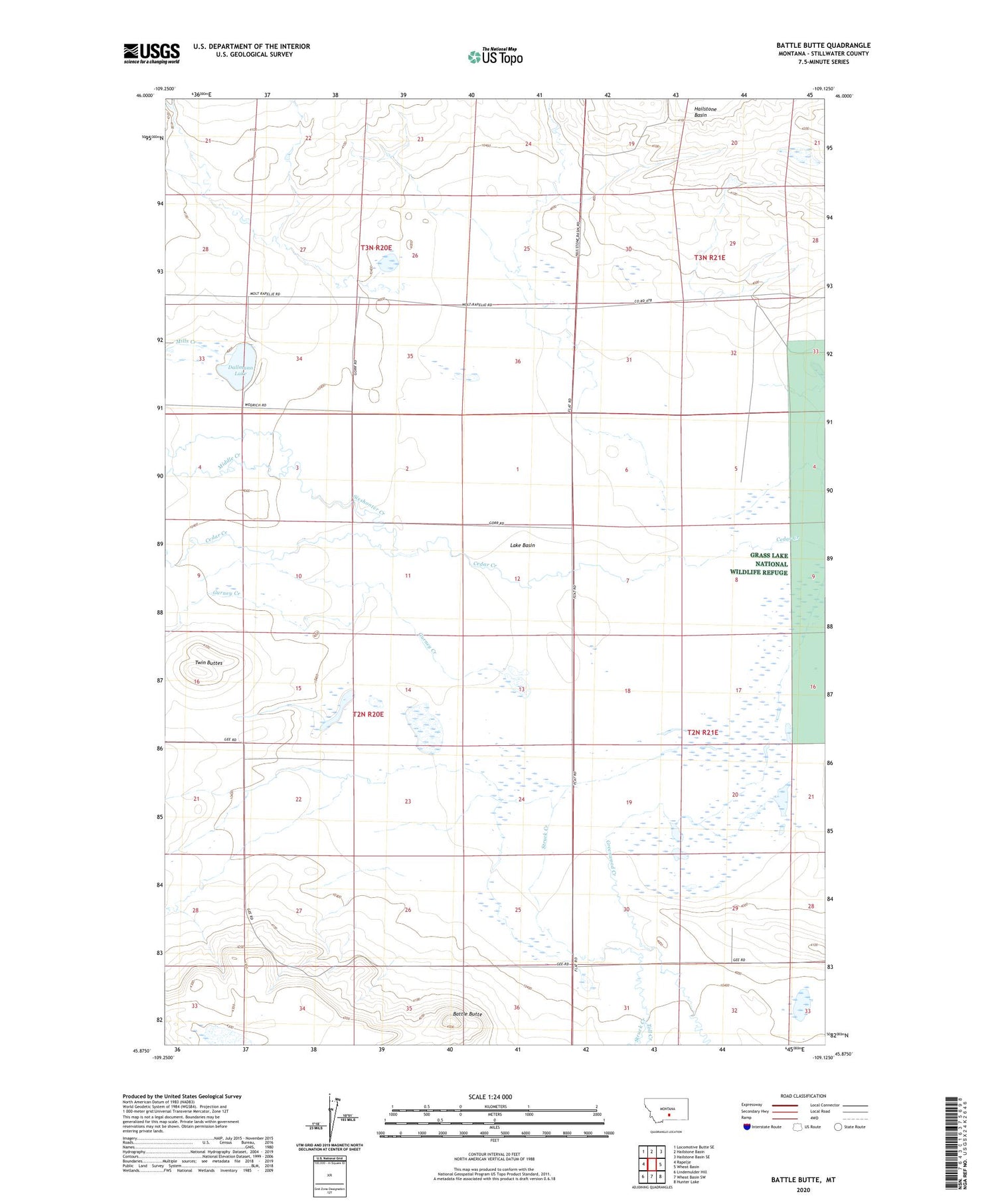
2020 topographic map quadrangle Battle Butte in the state of Montana. Scale: 1:24000. Based on the newly updated USGS 7.5' US Topo map series, this map is in the following counties: Stillwater. The map contains contour data, water features, and other items you are used to seeing on USGS maps, but also has updated roads and other features. This is the next generation of topographic maps. Printed on high-quality waterproof paper with UV fade-resistant inks.
Quads adjacent to this one:
West: Rapelje
Northwest: Locomotive Butte SE
North: Hailstone Basin
Northeast: Hailstone Basin SE
East: Wheat Basin
Southeast: Hunter Lake
South: Wheat Basin SW
Southwest: Lindemulder Hill
Contains the following named places: 02N20E15BAAD01 Well, Battle Butte, Dallmann Lake, Greenwood Creek, Gurney Creek, Hailstone National Wildlife Refuge Dam, Middle Creek, Mills Creek, North Stillwater Division, Sixshooter Creek, Struck Creek, Toll Creek, Twin Buttes