MyTopo
Wheat Basin SW Montana US Topo Map
Couldn't load pickup availability
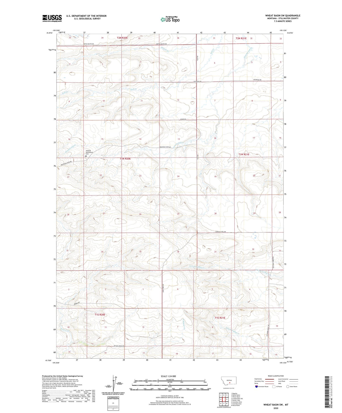
2024 topographic map quadrangle Wheat Basin SW in the state of Montana. Scale: 1:24000. Based on the newly updated USGS 7.5' US Topo map series, this map is in the following counties: Stillwater. The map contains contour data, water features, and other items you are used to seeing on USGS maps, but also has updated roads and other features. This is the next generation of topographic maps. Printed on high-quality waterproof paper with UV fade-resistant inks.
Quads adjacent to this one:
West: Lindemulder Hill
Northwest: Rapelje
North: Battle Butte
Northeast: Wheat Basin
East: Hunter Lake
Southeast: Horse Butte
South: Columbus East
Southwest: Columbus West
This map covers the same area as the classic USGS quad with code o45109g2.
Contains the following named places: 01S20E01CDDC01 Well, 01S21E07CCCB01 Well, Battle Butte School, Holland Settlement Cemetery, Pioneer School, Rummel Dam