MyTopo
Beaver Lake Montana US Topo Map
Couldn't load pickup availability
Also explore the Beaver Lake Forest Service Topo of this same quad for updated USFS data
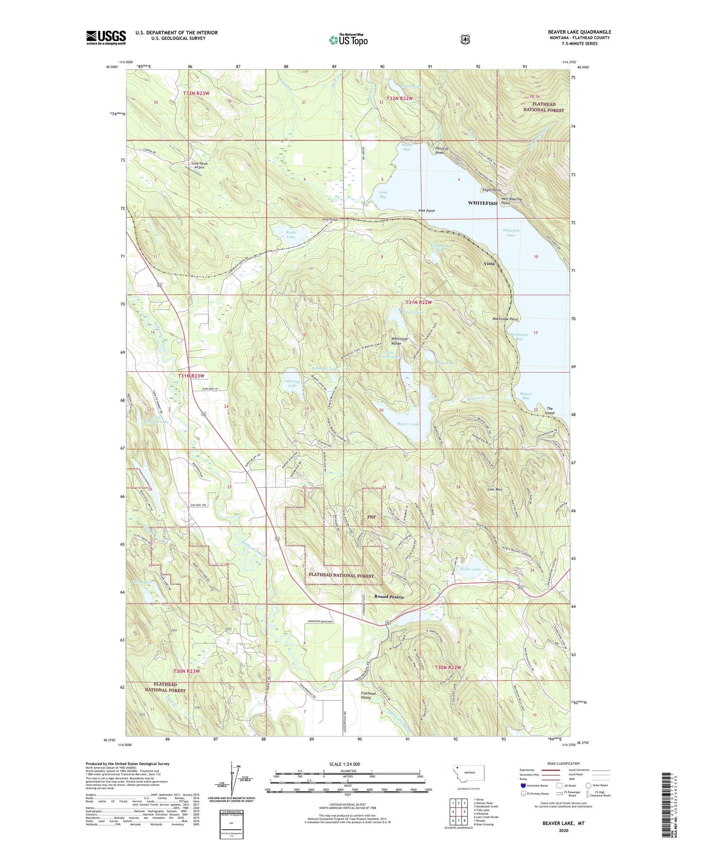
2024 topographic map quadrangle Beaver Lake in the state of Montana. Scale: 1:24000. Based on the newly updated USGS 7.5' US Topo map series, this map is in the following counties: Flathead. The map contains contour data, water features, and other items you are used to seeing on USGS maps, but also has updated roads and other features. This is the next generation of topographic maps. Printed on high-quality waterproof paper with UV fade-resistant inks.
Quads adjacent to this one:
West: Tally Lake
Northwest: Olney
North: Werner Peak
Northeast: Skookoleel Creek
East: Whitefish
Southeast: Rose Crossing
South: Rhodes
Southwest: Lost Creek Divide
This map covers the same area as the classic USGS quad with code o48114d4.
Contains the following named places: 30N23W01AB__01 Well, 31N23W02ADAB01 Well, 31N23W25AB__01 Well, 31N23W25ACCA01 Well, 31N23W36BDBA01 Well, Beaver Bay, Beaver Creek, Beaver Lake, Beaver Lake Fishing Access Site, Blodgett, Blodgett Post Office, Bootjack Lake, Bootjack Lake Fishing Access Site, Boyle Lake, Brush Bay, Brush Creek, Cliff Creek, Depew, Dollar Lake, Eagle Creek, Eagle Point, Hell Roaring Creek, Hell Roaring Point, Inez Point, Lazy Bay, Lazy Creek, Lion Mountain, Little Beaver Lake, Little Bootjack Lake, Lone Hawk Airport, Mackinaw Bay, Mackinaw Point, Murray Lake, Point of Pines, Rainbow Lake, Round Prairie, Skyles Lake, Skyles Lake Sportsmans Access, Smith Creek, Smith Lake, Spencer Lake, Swift Creek, Tamarack, The Island, Thornberg Lake, Twin Bridges, Twin Bridges School, Twin Lakes, Vista, Vista Tunnel, Whitefish Lake, Woods Lake