MyTopo
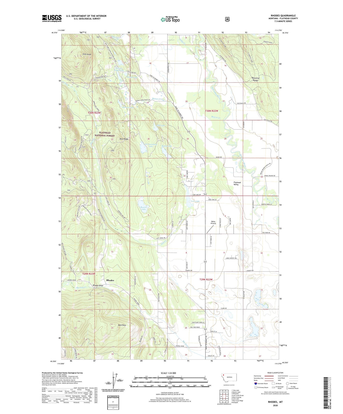
Rhodes Montana US Topo Map
Couldn't load pickup availability
Also explore the Rhodes Forest Service Topo of this same quad for updated USFS data
2024 topographic map quadrangle Rhodes in the state of Montana. Scale: 1:24000. Based on the newly updated USGS 7.5' US Topo map series, this map is in the following counties: Flathead. The map contains contour data, water features, and other items you are used to seeing on USGS maps, but also has updated roads and other features. This is the next generation of topographic maps. Printed on high-quality waterproof paper with UV fade-resistant inks.
Quads adjacent to this one:
West: Lost Creek Divide
Northwest: Tally Lake
North: Beaver Lake
Northeast: Whitefish
East: Rose Crossing
Southeast: Kalispell
South: Blue Grass Ridge
Southwest: Lone Lake
This map covers the same area as the classic USGS quad with code o48114c4.
Contains the following named places: 29N22W04CD__01 Well, 29N22W05AD__01 Well, 29N22W07DD__01 Well, 29N22W08ADDD01 Well, 29N22W08DC__01 Well, 29N22W08DD__01 Well, 29N22W09CC__01 Well, 29N22W09DD__01 Well, 29N22W10DC__01 Well, 29N22W10DC__02 Well, 29N22W15AD__01 Well, 29N22W15AD__02 Well, 29N22W15BBDD01 Well, 29N22W16AC__01 Well, 29N22W16CC__01 Well, 29N22W17AB__01 Well, 29N22W17DD__01 Well, 29N22W21BB__01 Well, 29N22W22BB__01 Well, 29N22W29BA__01 Well, 30N22W08CDDA01 Well, 30N22W08DCCD01 Well, 30N22W18BBBD01 Well, 30N22W27AB__01 Well, 30N22W28CD__01 Well, 30N22W28DB__01 Well, 30N22W34CBDD01 Well, 30N22W34CD__01 Well, Bald Rock, Bald Rock School, Baney Lake, Bates Airstrip, Beaver Creek, Bissell Grange Hall, Bowser Lake, Brown Creek, Cliff Lake, Hanson Lake, Hanson-Doyle Lake, Hawks Lake, Kuhns School, Lore Lake, Lost Creek, Northwest Flathead Community Hall, Northwestern Lake, Olney - Bissell School, Pete Ridge, Pilot Knob, Ray Kuhns Wildlife Management Area, Rhodes, Rhodes Census Designated Place, Rhodes Draw, Skyles Lake Dam, Sparks School, Stillwater Church, Tobie Creek