MyTopo
Bell Ridge West Montana US Topo Map
Couldn't load pickup availability
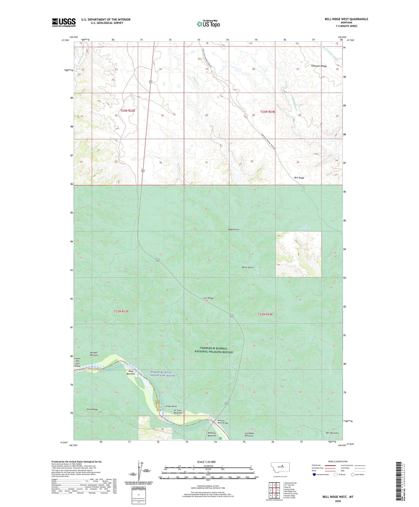
2020 topographic map quadrangle Bell Ridge West in the state of Montana. Scale: 1:24000. Based on the newly updated USGS 7.5' US Topo map series, this map is in the following counties: Phillips, Fergus. The map contains contour data, water features, and other items you are used to seeing on USGS maps, but also has updated roads and other features. This is the next generation of topographic maps. Printed on high-quality waterproof paper with UV fade-resistant inks.
Quads adjacent to this one:
West: Grand Island
Northwest: Shetland Divide
North: D Y Junction
Northeast: Hays SE
East: Bell Ridge East
Southeast: Carter Coulee
South: Hessler Ridge
Southwest: Mitchell Crossing
Contains the following named places: Bell Reservoir, Bell Ridge, Bogg Gulch, Duval Gulch, Grays Point, James Kipp Campground, James Kipp Recreation Area, Kendall Cow Camp, Knox Bottoms, Le Clair Bottoms, Lost Ridge, McNulty Bottoms, Missouri River Bridge