MyTopo
D Y Junction Montana US Topo Map
Couldn't load pickup availability
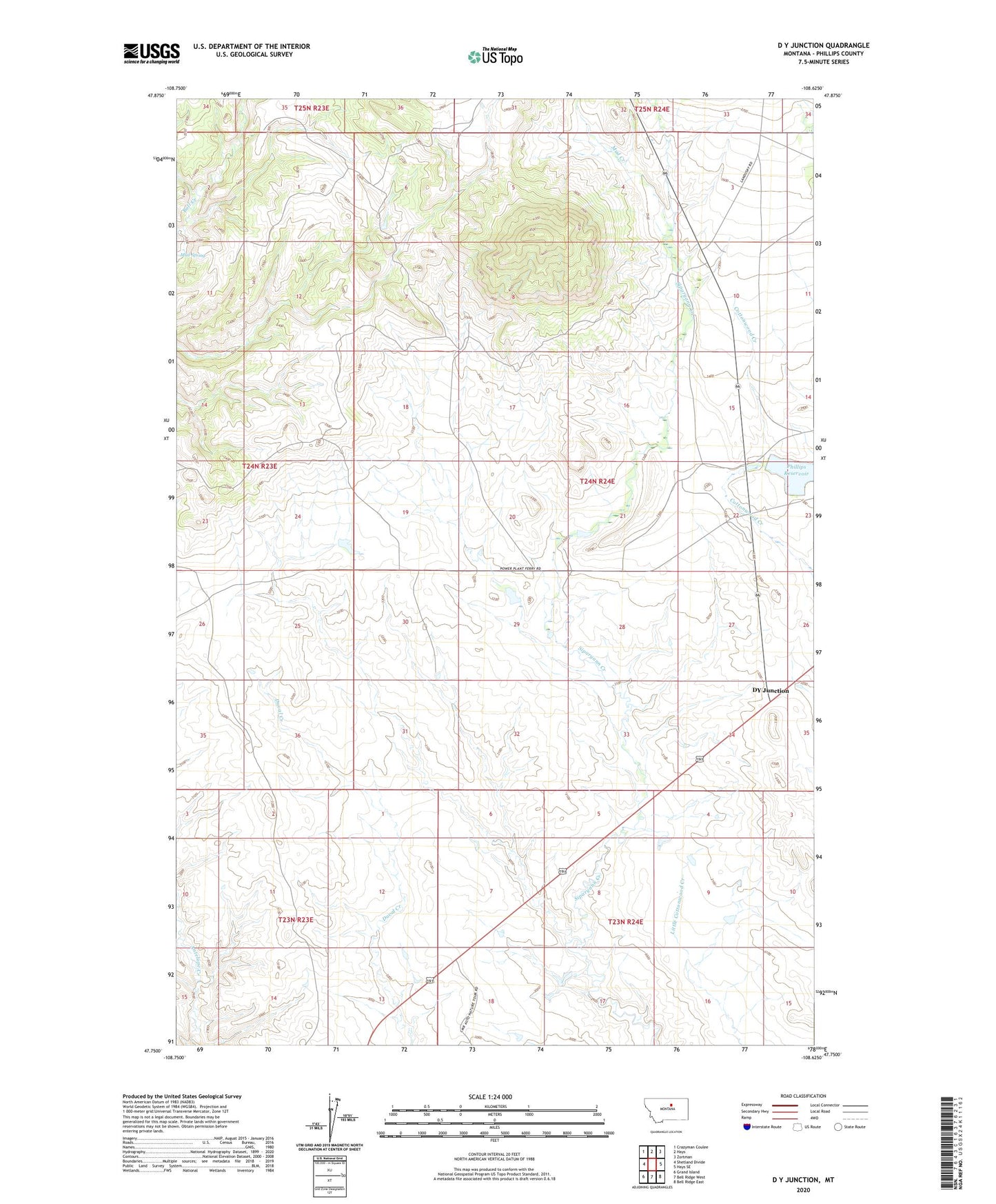
2024 topographic map quadrangle D Y Junction in the state of Montana. Scale: 1:24000. Based on the newly updated USGS 7.5' US Topo map series, this map is in the following counties: Phillips. The map contains contour data, water features, and other items you are used to seeing on USGS maps, but also has updated roads and other features. This is the next generation of topographic maps. Printed on high-quality waterproof paper with UV fade-resistant inks.
Quads adjacent to this one:
West: Shetland Divide
Northwest: Crazyman Coulee
North: Hays
Northeast: Zortman
East: Hays SE
Southeast: Bell Ridge East
South: Bell Ridge West
Southwest: Grand Island
This map covers the same area as the classic USGS quad with code o47108g6.
Contains the following named places: 23N23E15ABDD01 Well, 23N24E09CBA_01 Well, 24N24E34AC__01 Well, DY Junction, Hay Coulee, Mud Creek, Philips Dam, Phillips Reservoir, Piedmont School, Thornhill Butte