MyTopo
Hays SE Montana US Topo Map
Couldn't load pickup availability
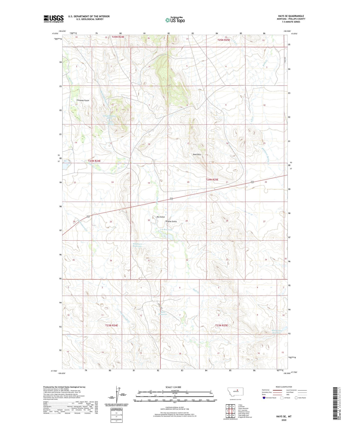
2024 topographic map quadrangle Hays SE in the state of Montana. Scale: 1:24000. Based on the newly updated USGS 7.5' US Topo map series, this map is in the following counties: Phillips. The map contains contour data, water features, and other items you are used to seeing on USGS maps, but also has updated roads and other features. This is the next generation of topographic maps. Printed on high-quality waterproof paper with UV fade-resistant inks.
Quads adjacent to this one:
West: D Y Junction
Northwest: Hays
North: Zortman
Northeast: Bear Mountain
East: Robinson School
Southeast: Sagebrush Reservoir
South: Bell Ridge East
Southwest: Bell Ridge West
This map covers the same area as the classic USGS quad with code o47108g5.
Contains the following named places: 24N24E12CDDA01 Spring, 24N24E25CB__01 Well, 24N24E25CBC_01 Well, 59546, Chimney Gulch, Dry Gulch, Grouse Gulch, Grouse Gulch School, J D Reservoir, Kieth Coulee, Lazy J-D Number 1 Dam, Little Rockies Camp, Little Rocky Mountains Historical Marker, McChesney Reservoir, McChesney Reservoir Dam, Pearl Reservoir, Ruby Creek, Sand Hills, The Plunge, Warm Springs Creek, Waydown Reservoir, Whitmore Spring Creek