MyTopo
Belle Creek SW Montana US Topo Map
Couldn't load pickup availability
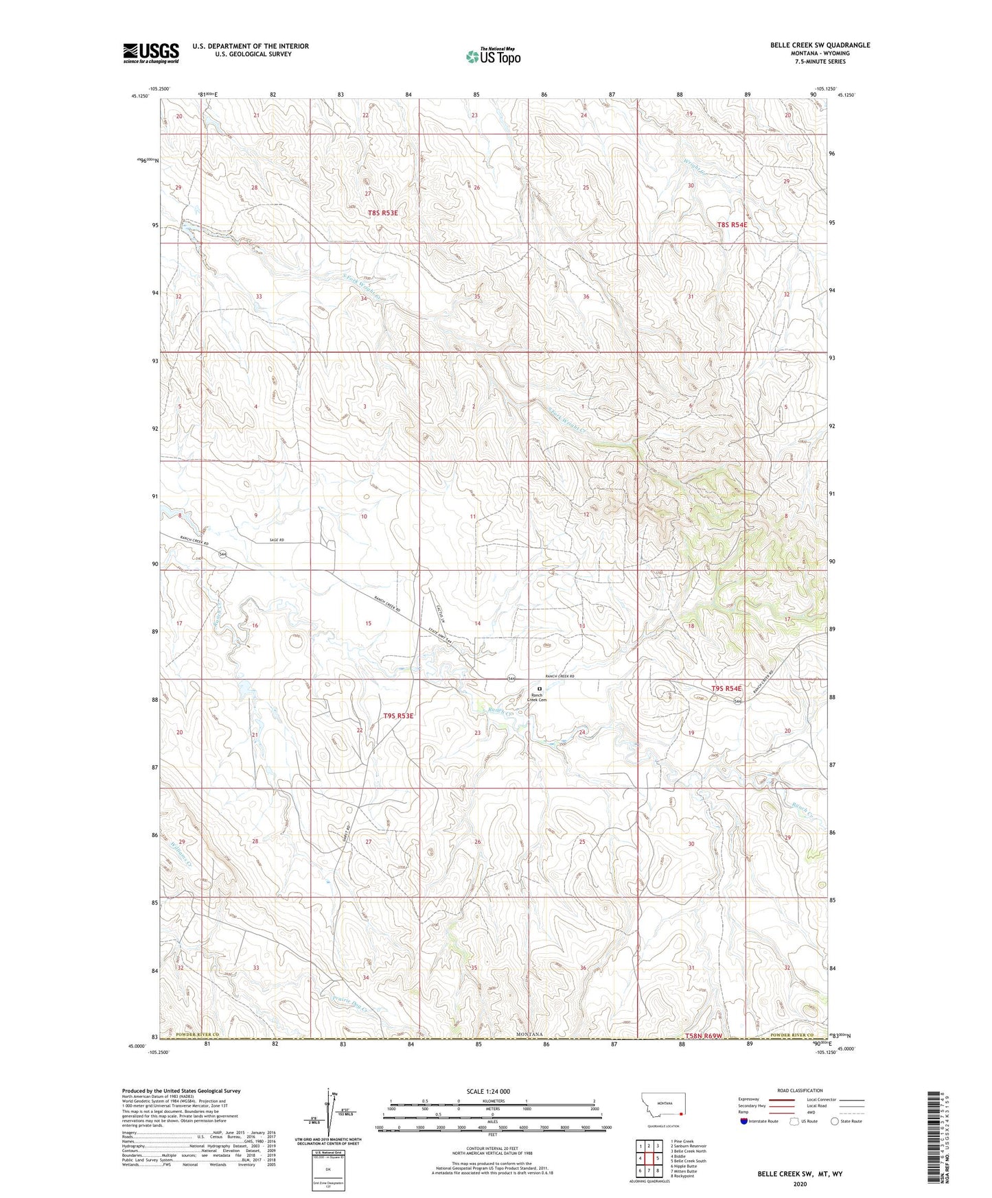
2024 topographic map quadrangle Belle Creek SW in the state of Montana. Scale: 1:24000. Based on the newly updated USGS 7.5' US Topo map series, this map is in the following counties: Powder River, Campbell. The map contains contour data, water features, and other items you are used to seeing on USGS maps, but also has updated roads and other features. This is the next generation of topographic maps. Printed on high-quality waterproof paper with UV fade-resistant inks.
Quads adjacent to this one:
West: Biddle
Northwest: Pine Creek
North: Sanburn Reservoir
Northeast: Belle Creek North
East: Belle Creek South
Southeast: Rockypoint
South: Mitten Butte
Southwest: Nipple Butte
Contains the following named places: 08S54E29CCCA01 Well, 08S54E30BDAA01 Well, 09S53E22ABAC01 Well, 09S53E22ABB_01 Well, 09S53E36AABD01 Well, 09S54E19CC__01 Well, Giacometto Number 1 Dam, Morris Ranch Airport, Porch Number 1 Dam, R Garst Number 1 Dam, R Garst Number 2 Dam, Ranch Creek Cemetery