MyTopo
Biddle Montana US Topo Map
Couldn't load pickup availability
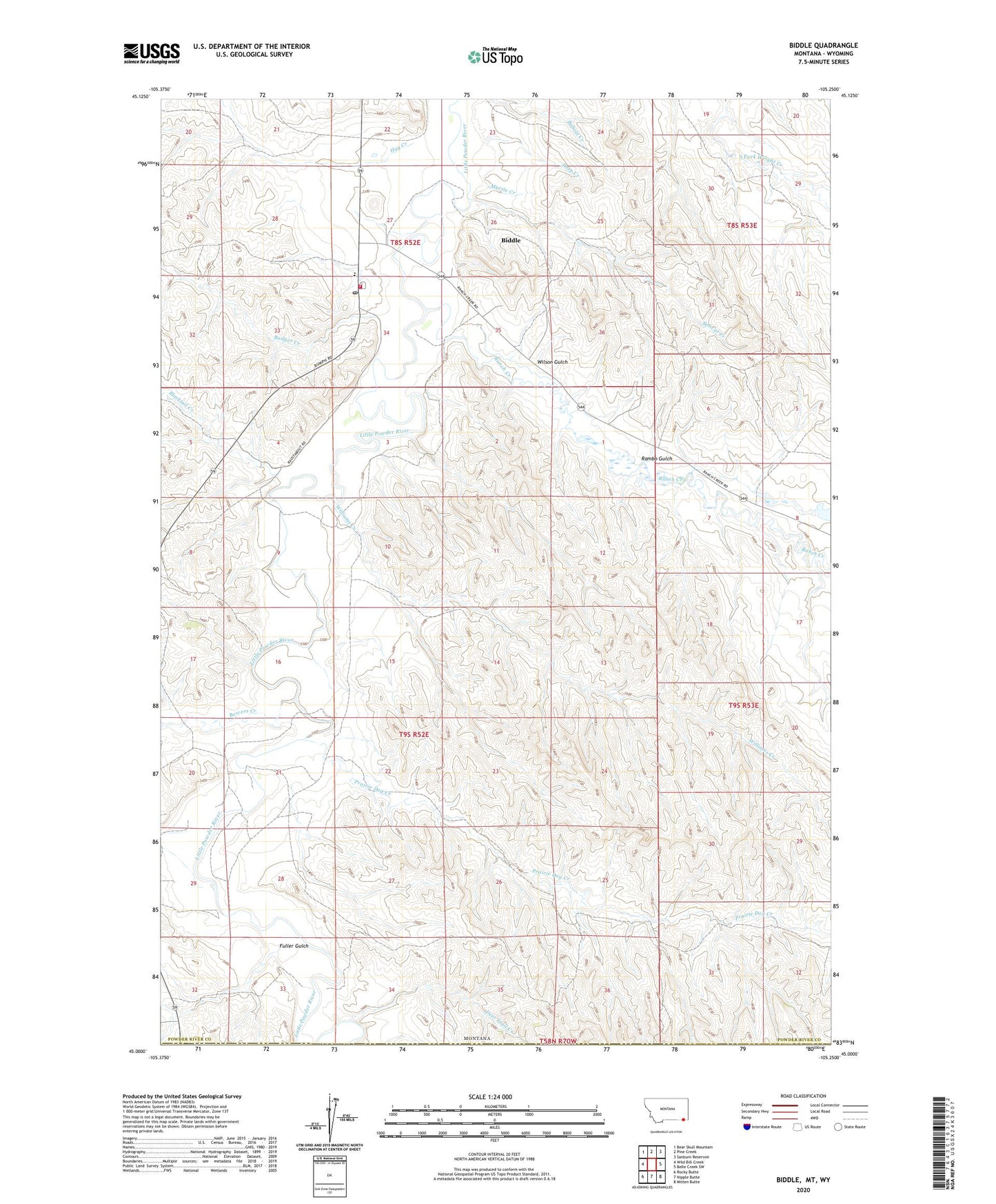
2024 topographic map quadrangle Biddle in the state of Montana. Scale: 1:24000. Based on the newly updated USGS 7.5' US Topo map series, this map is in the following counties: Powder River, Campbell. The map contains contour data, water features, and other items you are used to seeing on USGS maps, but also has updated roads and other features. This is the next generation of topographic maps. Printed on high-quality waterproof paper with UV fade-resistant inks.
Quads adjacent to this one:
West: Wild Bill Creek
Northwest: Bear Skull Mountain
North: Pine Creek
Northeast: Sanburn Reservoir
East: Belle Creek SW
Southeast: Mitten Butte
South: Nipple Butte
Southwest: Rocky Butte
Contains the following named places: 08S52E20ADA_01 Well, 08S52E27CC__01 Well, 08S52E27DD__01 Well, 08S53E29BCBB01 Well, 09S52E13DC__01 Well, 09S52E16CCCB01 Well, 59314, Badger Creek, Biddle, Biddle Census Designated Place, Biddle Post Office, Biddle Volunteer Fire Department, Blacktail Creek, Bobcat Creek, Bowers Creek, Deep Creek, Deer Trail Creek, Fuller Gulch, Hay Creek, Kendricknumber 1 Dam, Little Hay Creek, Myrtle Creek, Prairie Dog Creek, Rambo Gulch, Ranch Creek, Wild Bill Creek, Williams Creek, Wilson Gulch