MyTopo
Haystack Butte Montana US Topo Map
Couldn't load pickup availability
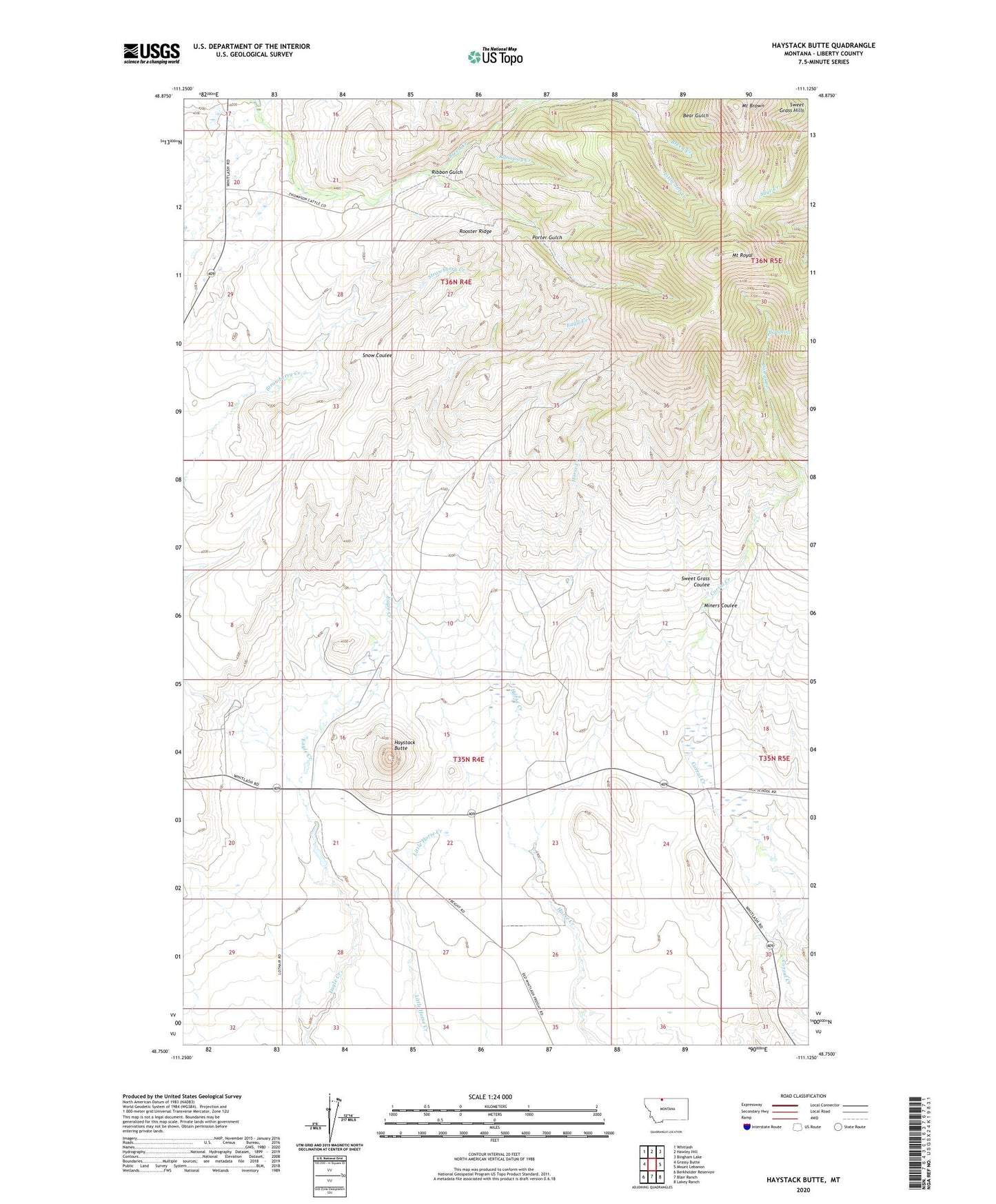
2024 topographic map quadrangle Haystack Butte in the state of Montana. Scale: 1:24000. Based on the newly updated USGS 7.5' US Topo map series, this map is in the following counties: Liberty. The map contains contour data, water features, and other items you are used to seeing on USGS maps, but also has updated roads and other features. This is the next generation of topographic maps. Printed on high-quality waterproof paper with UV fade-resistant inks.
Quads adjacent to this one:
West: Grassy Butte
Northwest: Whitlash
North: Hawley Hill
Northeast: Bingham Lake
East: Mount Lebanon
Southeast: Lakey Ranch
South: Blair Ranch
Southwest: Berkholder Reservoir
This map covers the same area as the classic USGS quad with code o48111g2.
Contains the following named places: 35N04E21DCBC01 Well, 36N04E21DBDA01 Well, B Oswood Ranch, Big Spring, Breed Creek Mine, Brown Eyed Queen Mine, Camp Otis, Forseth Ranch, Gannion Mine, Haystack Butte, Hill, Hill Post Office, Hill School, Hofer Ranch, L Oswood Ranch, Little Joe Creek, Lower Gannion Mine, Miners Coulee, Mount Brown, Mount Royal, Porter Gulch, Ribbon Gulch, Ribbon Gulch Mine, Rooster Ridge, Runaway Creek, Sweet Grass Coulee, Wickum School