MyTopo
Big Coulee Montana US Topo Map
Couldn't load pickup availability
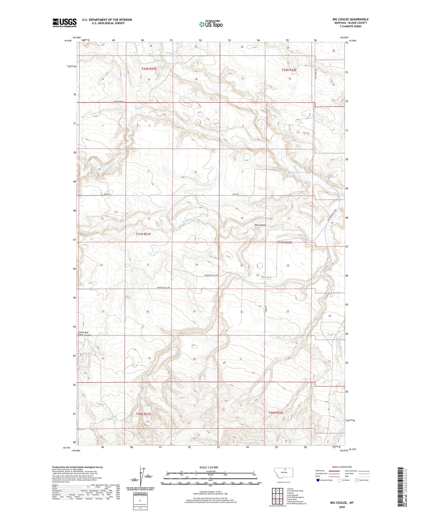
2024 topographic map quadrangle Big Coulee in the state of Montana. Scale: 1:24000. Based on the newly updated USGS 7.5' US Topo map series, this map is in the following counties: Blaine. The map contains contour data, water features, and other items you are used to seeing on USGS maps, but also has updated roads and other features. This is the next generation of topographic maps. Printed on high-quality waterproof paper with UV fade-resistant inks.
Quads adjacent to this one:
West: Cleveland NE
Northwest: Zurich
North: Fort Belknap Siding
Northeast: Harlem
East: Fort Belknap Agency
Southeast: Fort Belknap Agency SE
South: Newhouse Reservoir
Southwest: Miles Butte
This map covers the same area as the classic USGS quad with code o48108d8.
Contains the following named places: 31N21E25BDDB01 Well, Big Coulee, Blaine County, Box Elder Creek, Brinkman Dam, Hansen Dam, Snake Butte School, Willow Dam