MyTopo
Miles Butte Montana US Topo Map
Couldn't load pickup availability
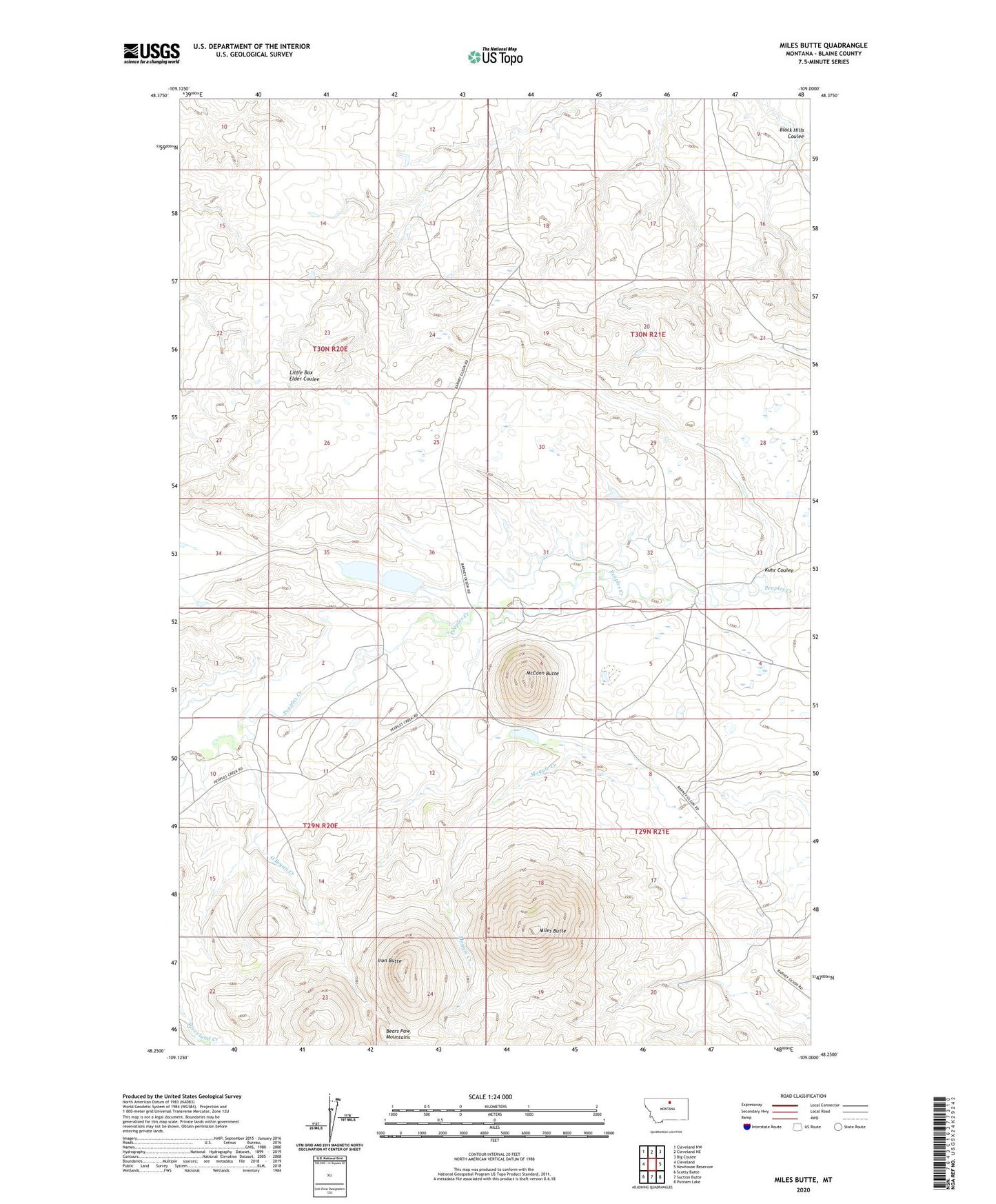
2024 topographic map quadrangle Miles Butte in the state of Montana. Scale: 1:24000. Based on the newly updated USGS 7.5' US Topo map series, this map is in the following counties: Blaine. The map contains contour data, water features, and other items you are used to seeing on USGS maps, but also has updated roads and other features. This is the next generation of topographic maps. Printed on high-quality waterproof paper with UV fade-resistant inks.
Quads adjacent to this one:
West: Cleveland
Northwest: Cleveland NW
North: Cleveland NE
Northeast: Big Coulee
East: Newhouse Reservoir
Southeast: Putnam Lake
South: Suction Butte
Southwest: Scotty Butte
This map covers the same area as the classic USGS quad with code o48109c1.
Contains the following named places: Iron Butte, Kuhr Coulee, Kuhr Number 2 Dam, Kuhr-McCann School, McCann Butte, Miles Butte, O'Bryan Creek, Ramberg School, Ramburg, Ramburg Post Office, Yukon Jack Dam, Yuletide Dam