MyTopo
Big Marys Island Montana US Topo Map
Couldn't load pickup availability
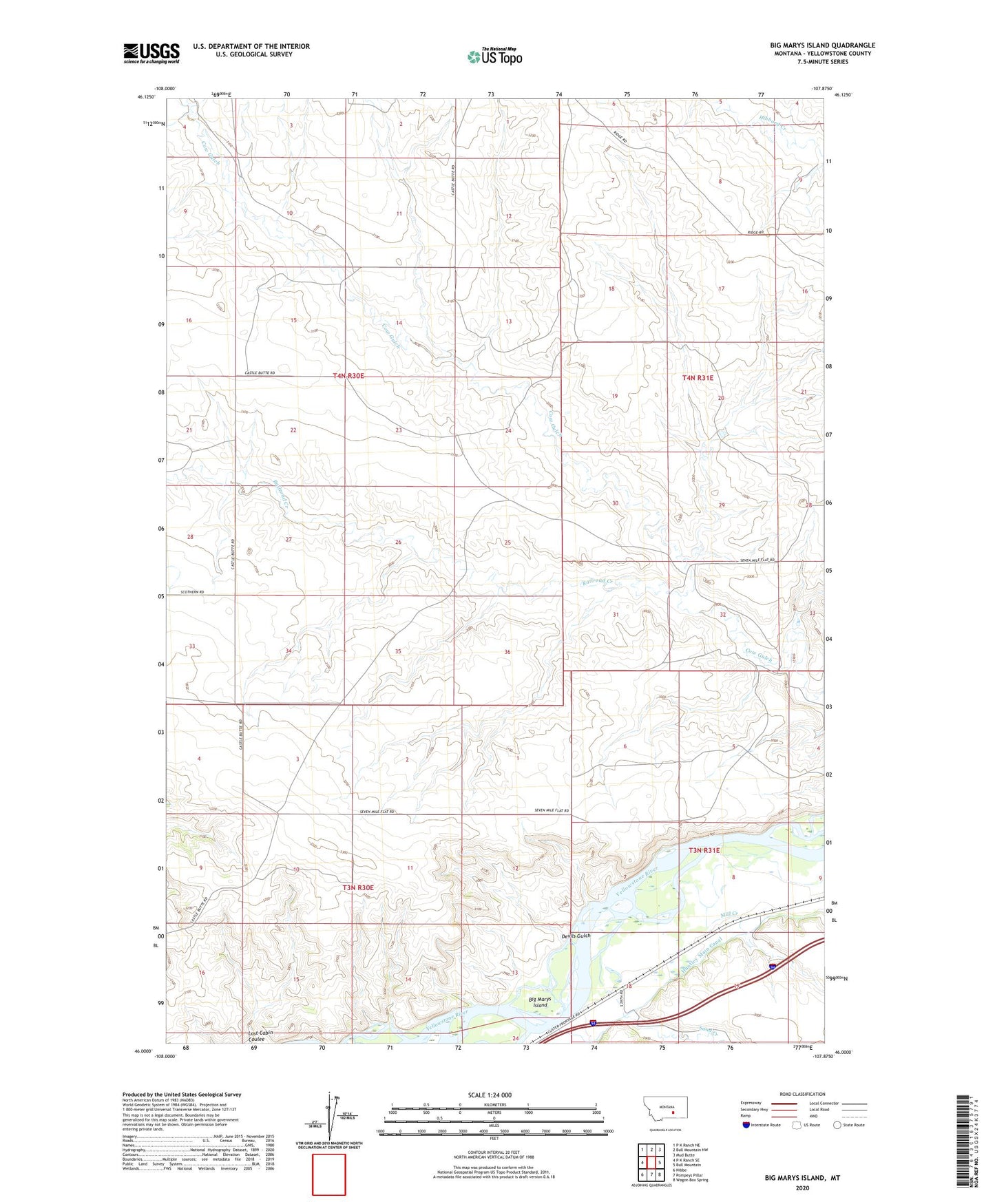
2024 topographic map quadrangle Big Marys Island in the state of Montana. Scale: 1:24000. Based on the newly updated USGS 7.5' US Topo map series, this map is in the following counties: Yellowstone. The map contains contour data, water features, and other items you are used to seeing on USGS maps, but also has updated roads and other features. This is the next generation of topographic maps. Printed on high-quality waterproof paper with UV fade-resistant inks.
Quads adjacent to this one:
West: P K Ranch SE
Northwest: P K Ranch NE
North: Bull Mountain NW
Northeast: Mud Butte
East: Bull Mountain
Southeast: Wagon Box Spring
South: Pompeys Pillar
Southwest: Nibbe
This map covers the same area as the classic USGS quad with code o46107a8.
Contains the following named places: 03N30E10CDBC01 Well, Big Marys Island, Devils Gulch, Mill Creek, Railroad Creek, Sand Creek