MyTopo
Mud Butte Montana US Topo Map
Couldn't load pickup availability
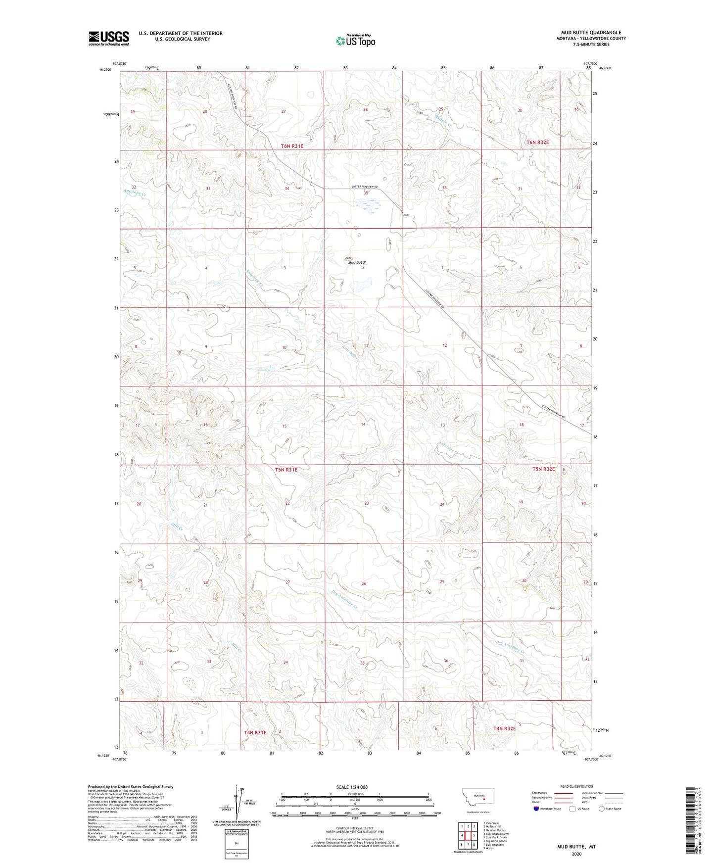
2024 topographic map quadrangle Mud Butte in the state of Montana. Scale: 1:24000. Based on the newly updated USGS 7.5' US Topo map series, this map is in the following counties: Yellowstone. The map contains contour data, water features, and other items you are used to seeing on USGS maps, but also has updated roads and other features. This is the next generation of topographic maps. Printed on high-quality waterproof paper with UV fade-resistant inks.
Quads adjacent to this one:
West: Bull Mountain NW
Northwest: Pine View
North: Mailbox Hill
Northeast: Mexican Buttes
East: Coal Bank Creek
Southeast: Waco
South: Bull Mountain
Southwest: Big Marys Island
This map covers the same area as the classic USGS quad with code o46107b7.
Contains the following named places: 06N31E27CACC01 Well, Mud Butte