MyTopo
Bingham Lake Montana US Topo Map
Couldn't load pickup availability
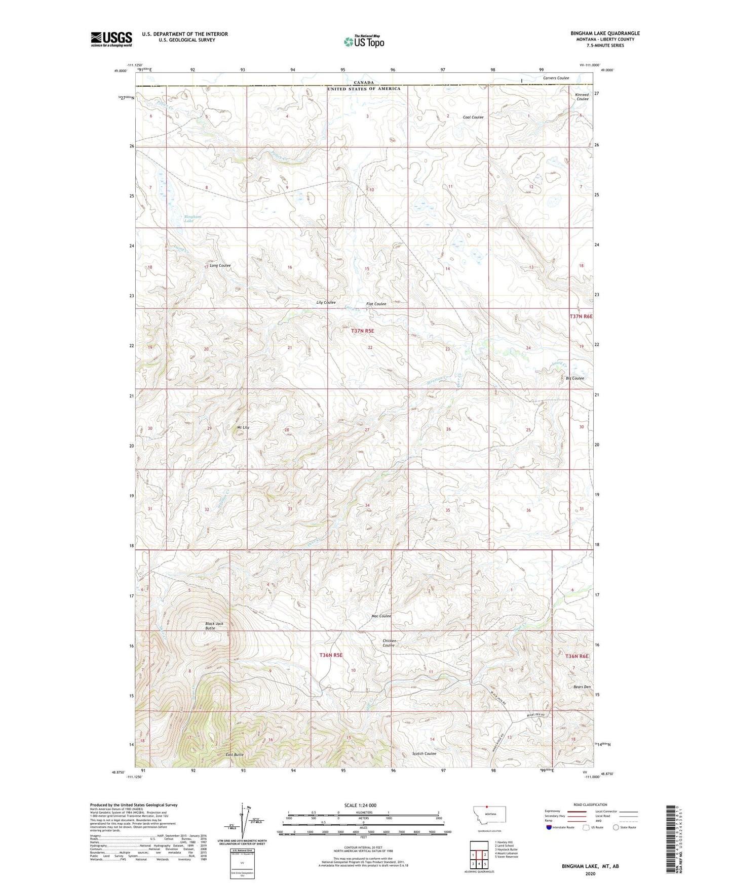
2024 topographic map quadrangle Bingham Lake in the state of Montana. Scale: 1:24000. Based on the newly updated USGS 7.5' US Topo map series, this map is in the following counties: Liberty. The map contains contour data, water features, and other items you are used to seeing on USGS maps, but also has updated roads and other features. This is the next generation of topographic maps. Printed on high-quality waterproof paper with UV fade-resistant inks.
Quads adjacent to this one:
West: Hawley Hill
East: Laird School
Southeast: Vaver Reservoir
South: Mount Lebanon
Southwest: Haystack Butte
This map covers the same area as the classic USGS quad with code o48111h1.
Contains the following named places: 36N05E03DDAC01 Well, 36N05E09ACDB01 Well, 36N06E06BABD01 Well, 37N05E05CAAC01 Well, 37N05E08AABD01 Well, 37N05E09ACCA01 Well, 37N05E09BBDB01 Well, 37N05E09DACB01 Well, Bears Den Oil and Gas Field, Big Coulee, Bingham Lake, Black Jack Butte, Bond Ranch, Dafoe Ranch, Deer Creek, Flat Coulee, Flat Coulee Oil and Gas Field, Kinreed Coulee, Laird Post Office, Lily Coulee, Long Coulee, Mount Lily, Old Banks Place, Old Laird Ranch, Onstad Dam, Stratton Creek