MyTopo
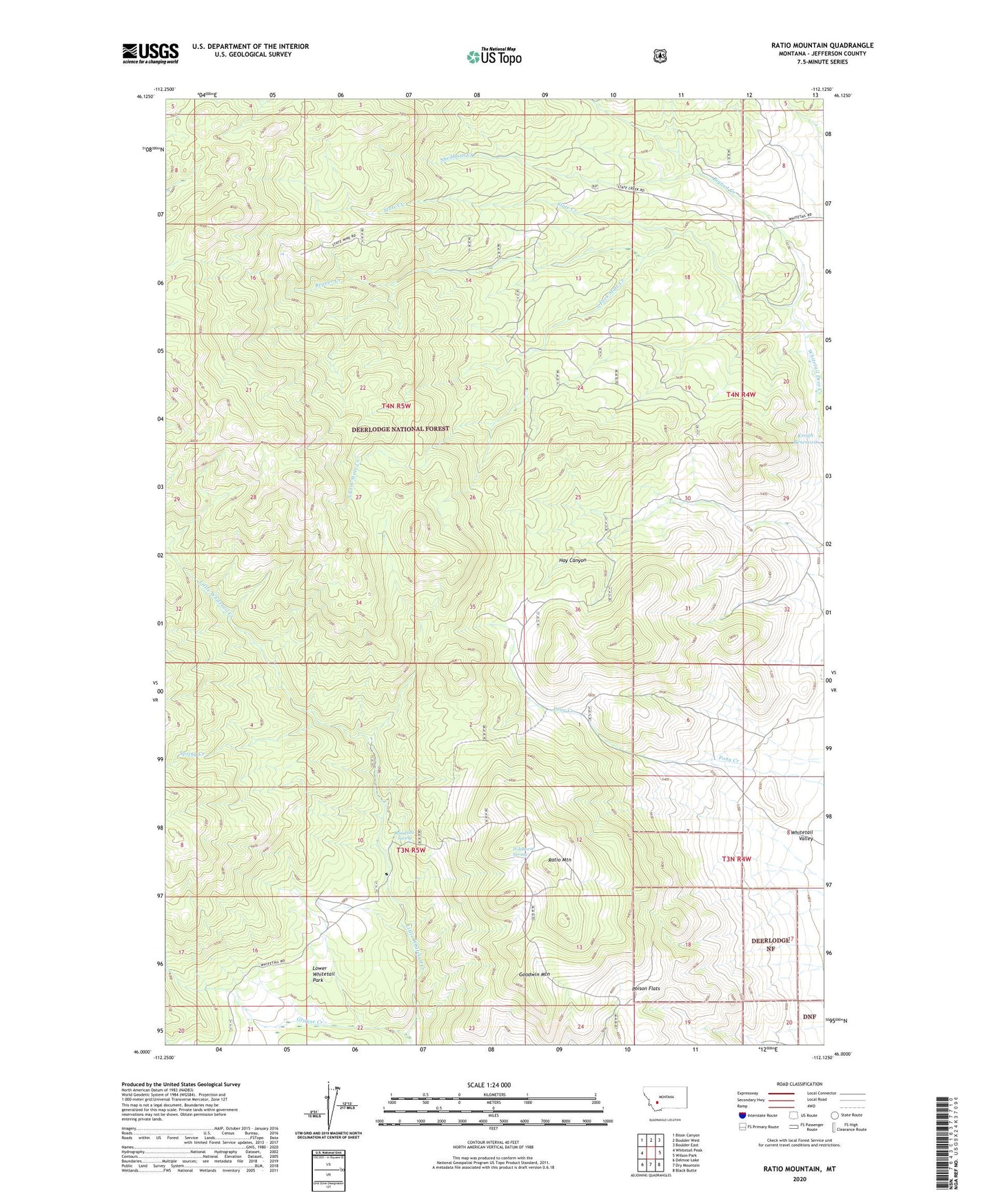
Ratio Mountain Montana US Topo Map
Couldn't load pickup availability
Also explore the Ratio Mountain Forest Service Topo of this same quad for updated USFS data
2024 topographic map quadrangle Ratio Mountain in the state of Montana. Scale: 1:24000. Based on the newly updated USGS 7.5' US Topo map series, this map is in the following counties: Jefferson. The map contains contour data, water features, and other items you are used to seeing on USGS maps, but also has updated roads and other features. This is the next generation of topographic maps. Printed on high-quality waterproof paper with UV fade-resistant inks.
Quads adjacent to this one:
West: Whitetail Peak
Northwest: Bison Canyon
North: Boulder West
Northeast: Boulder East
East: Wilson Park
Southeast: Black Butte
South: Dry Mountain
Southwest: Delmoe Lake
This map covers the same area as the classic USGS quad with code o46112a2.
Contains the following named places: Ajax Mine, Attowa Mine, Beaver Creek, Beaver Creek Mine, Beaver Placer Mine, Big Foot, Bigfoot Creek, Goodwin Mountain, Grouse Creek, Lower Whitetail Park, Mountain Queen Mine, NE SW Section 3 Mine, NW NW Section 21 Mine, Poison Flats, Ratio Mountain, Roadside Spring, Saint Anthony Mine, Shedhorn Creek, South Fork State Creek, Spring Creek, State Creek, State Mine, Upper Whitetail Park Trail, Wildhorse Spring