MyTopo
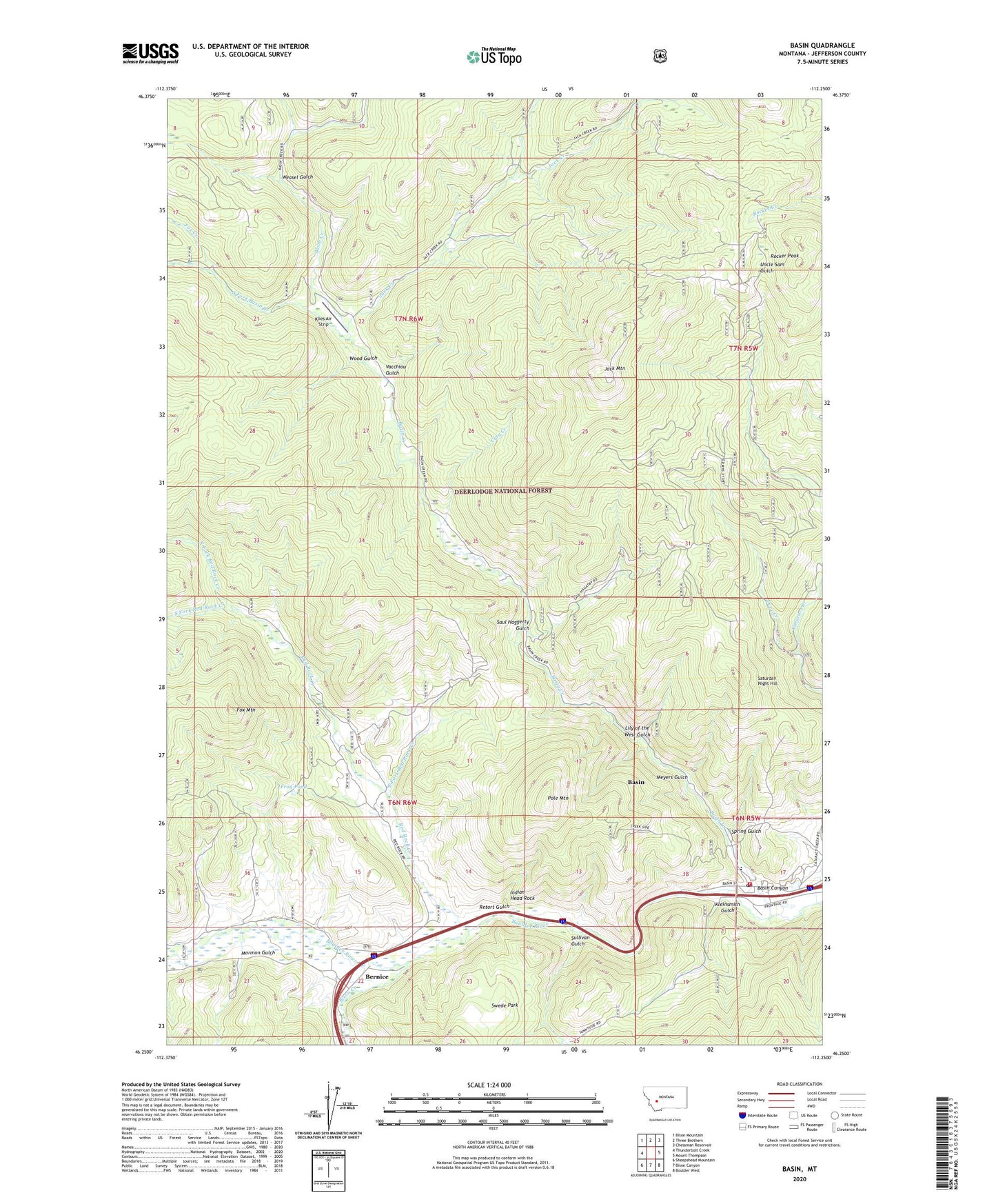
Basin Montana US Topo Map
Couldn't load pickup availability
Also explore the Basin Forest Service Topo of this same quad for updated USFS data
2024 topographic map quadrangle Basin in the state of Montana. Scale: 1:24000. Based on the newly updated USGS 7.5' US Topo map series, this map is in the following counties: Jefferson. The map contains contour data, water features, and other items you are used to seeing on USGS maps, but also has updated roads and other features. This is the next generation of topographic maps. Printed on high-quality waterproof paper with UV fade-resistant inks.
Quads adjacent to this one:
West: Thunderbolt Creek
Northwest: Bison Mountain
North: Three Brothers
Northeast: Chessman Reservoir
East: Mount Thompson
Southeast: Boulder West
South: Bison Canyon
Southwest: Sheepshead Mountain
This map covers the same area as the classic USGS quad with code o46112c3.
Contains the following named places: Aurora Mine, Basin, Basin Canyon, Basin Canyon Campground, Basin Canyon Picnic Ground, Basin Census Designated Place, Basin Creek, Basin Millsite, Basin Montana Volunteer Fire Department, Basin Post Office, Basin School, Bauernfeind Mine, Bernice, Bernice Post Office, Binghampton Mine, Bison Creek, Blomberg, Blue Bell Health Mine, Boulder Mine, Boulder Mountains, Bullion Mine, Calvin, Clay Creek, Crystal Mine, Deer Creek, Doris Mine, East Fork Red Rock Creek, Eureka Mine, Evening Star Mine, First Shot Mine, Fox Creek, Fox Mountain, Frog Pond, Garfiel Extension Mine, Hector Mine, Helper Mine, Hope Mine, Hope Mine Spur, Indian Head Rock, Indian Head Rock Mine, Jack Creek, Jack Creek Tailings, Jack Mountain, James/Holland/Alpine Mine, Jasper, Joe Bowers Creek, Kleinsmith Gulch, Klies Air Strip, Lily of the West Gulch, Mammoth/Crystal Mine, Marey An Mine, Marguerite Mine, Meyers Gulch, Meyers Gulch Mine, Mining Country Historical Marker, Moccason Mine, Mormon Campground, Mormon Gulch, Mormon Gulch Campground, Morning Mine, NE Basin Mine, NE NE Section 13 Mine, North Fork Red Rock Creek, NW NE Section 32 Mine, NW SW Section 29 Mine, NW SW Section 7 Mine, O'Neill Campground, Pole Mountain, Red Rock Creek, Red Rock Mine, Retort Gulch, Rocker Peak, Saturday Night Hill, Saul Haggerty Gulch, SE SW Section 32 Mine, South Fork Basin Creek, South Fork Red Rock Creek, Sparkling Water Mine, Spring Gulch, Sullivan Gulch, Sunnyside Ranger Station, SW NE Section 32 Mine, SW NW Section 29 Mine, SW SE Section 1 Mine, SW SE Section 13 Mine, SW SE Section 29 Mine, Swede Park, Vacchiou Gulch, Weasel Gulch, White Pine/Custer Mine, Winters Camp, Winters Camp Mine, Wood Gulch