MyTopo
Blankenbaker Flats Montana US Topo Map
Couldn't load pickup availability
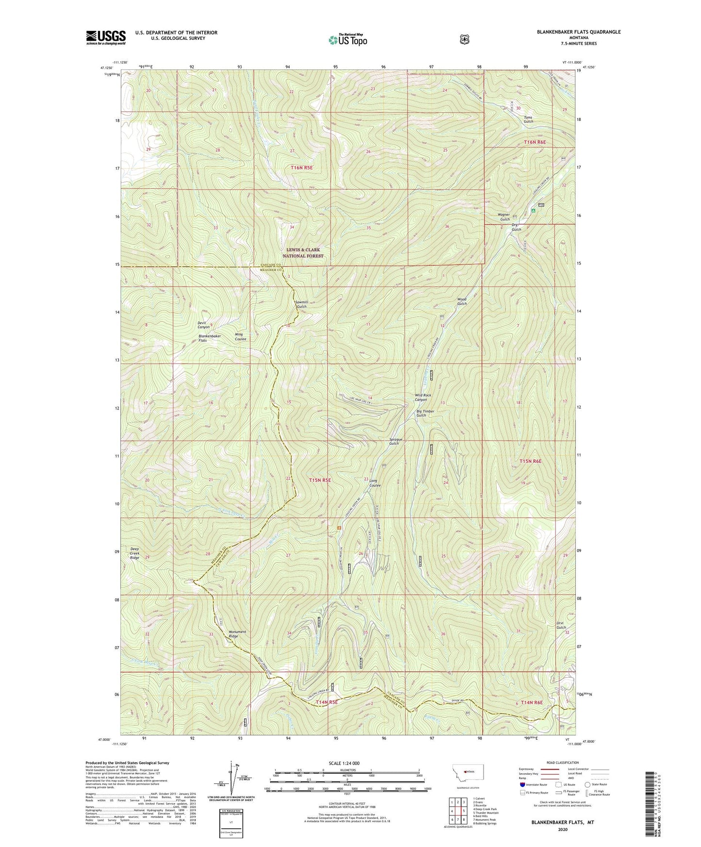
2020 topographic map quadrangle Blankenbaker Flats in the state of Montana. Scale: 1:24000. Based on the newly updated USGS 7.5' US Topo map series, this map is in the following counties: Cascade, Meagher. The map contains contour data, water features, and other items you are used to seeing on USGS maps, but also has updated roads and other features. This is the next generation of topographic maps. Printed on high-quality waterproof paper with UV fade-resistant inks.
Quads adjacent to this one:
West: Deep Creek Park
Northwest: Calvert
North: Evans
Northeast: Riceville
East: Thunder Mountain
Southeast: Bubbling Springs
South: Monument Peak
Southwest: Bald Hills
Contains the following named places: Big Timber Gulch, Blankenbaker Flats, Carbonate, Deep Creek Figure 8 Loop National Recreation Trail, Deep Creek Ridge, Dry Gulch, Logging Creek Campground, Long Coulee, Mill Creek, Monument Ridge, Sprague Gulch, Toms Gulch, Wagner Gulch, Wild Rock Canyon, Wood Gulch