MyTopo
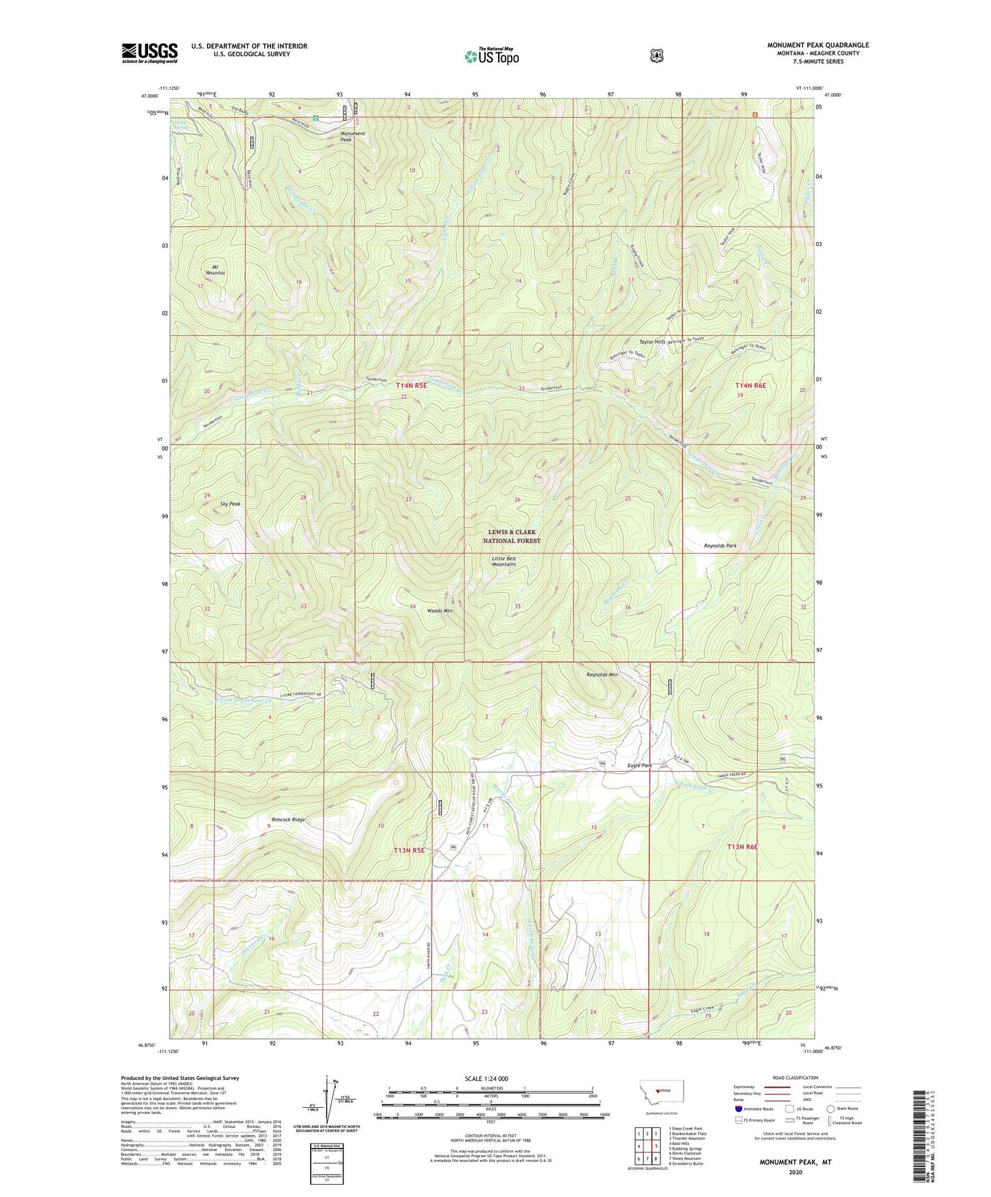
Monument Peak Montana US Topo Map
Couldn't load pickup availability
Also explore the Monument Peak Forest Service Topo of this same quad for updated USFS data
2024 topographic map quadrangle Monument Peak in the state of Montana. Scale: 1:24000. Based on the newly updated USGS 7.5' US Topo map series, this map is in the following counties: Meagher. The map contains contour data, water features, and other items you are used to seeing on USGS maps, but also has updated roads and other features. This is the next generation of topographic maps. Printed on high-quality waterproof paper with UV fade-resistant inks.
Quads adjacent to this one:
West: Bald Hills
Northwest: Deep Creek Park
North: Blankenbaker Flats
Northeast: Thunder Mountain
East: Bubbling Springs
Southeast: Strawberry Butte
South: Sheep Mountain
Southwest: Devils Footstool
This map covers the same area as the classic USGS quad with code o46111h1.
Contains the following named places: Balsinger Creek, Devils Creek, Eagle Park, East Fork Fisher Creek, Fisher Creek, Monument Park, Monument Peak, Mount Vesuvius, NW NW Section 30 Mine, Packsaddle Creek, Reynolds Creek, Reynolds Mountain, Reynolds Park, Rimrock Ridge, Rugby Creek, Sky Peak, Taylor Creek, Taylor Hills, Urvi Creek, Woods Creek, Woods Mountain