MyTopo
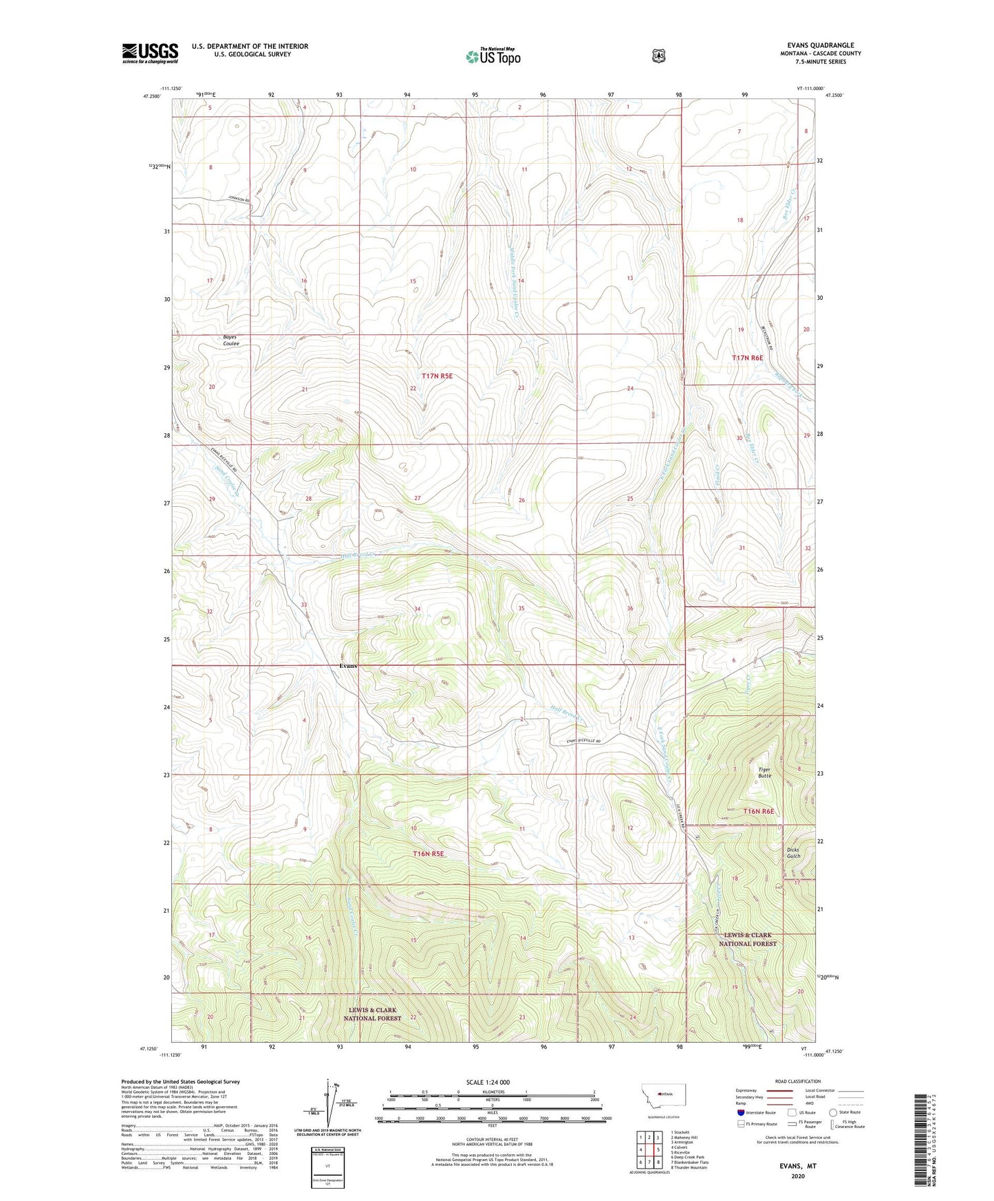
Evans Montana US Topo Map
Couldn't load pickup availability
Also explore the Evans Forest Service Topo of this same quad for updated USFS data
2024 topographic map quadrangle Evans in the state of Montana. Scale: 1:24000. Based on the newly updated USGS 7.5' US Topo map series, this map is in the following counties: Cascade. The map contains contour data, water features, and other items you are used to seeing on USGS maps, but also has updated roads and other features. This is the next generation of topographic maps. Printed on high-quality waterproof paper with UV fade-resistant inks.
Quads adjacent to this one:
West: Calvert
Northwest: Stockett
North: Mahoney Hill
Northeast: Armington
East: Riceville
Southeast: Thunder Mountain
South: Blankenbaker Flats
Southwest: Deep Creek Park
This map covers the same area as the classic USGS quad with code o47111b1.
Contains the following named places: Beaudry Fork, Evans, Evans Post Office, Evans School, Flood Creek, Half Breed Creek, Houskin Post Office, Houskin School, Tiger, Tiger Butte, Tiger Butte Post Office, Tiger Butte School, Upper Sand Coulee School