MyTopo
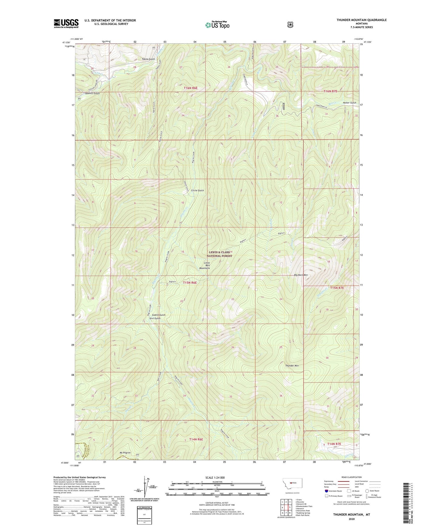
Thunder Mountain Montana US Topo Map
Couldn't load pickup availability
Also explore the Thunder Mountain Forest Service Topo of this same quad for updated USFS data
2024 topographic map quadrangle Thunder Mountain in the state of Montana. Scale: 1:24000. Based on the newly updated USGS 7.5' US Topo map series, this map is in the following counties: Cascade, Meagher. The map contains contour data, water features, and other items you are used to seeing on USGS maps, but also has updated roads and other features. This is the next generation of topographic maps. Printed on high-quality waterproof paper with UV fade-resistant inks.
Quads adjacent to this one:
West: Blankenbaker Flats
Northwest: Evans
North: Riceville
Northeast: Monarch NE
East: Monarch
Southeast: Belt Park Butte
South: Bubbling Springs
Southwest: Monument Peak
This map covers the same area as the classic USGS quad with code o47110a8.
Contains the following named places: Big Horn Mountain, Circle Gulch, Deer Creek, Goblin Gulch, Holter Gulch, Holters Siding, Iron Creek, Lick Creek, Meade Guard Station, Mount Pilgrim, Pilgrim Creek, Sawmill Gulch, Thunder Mountain, Tobins Gulch, Tylers Spur, Urvi Gulch, Virgin Creek