MyTopo
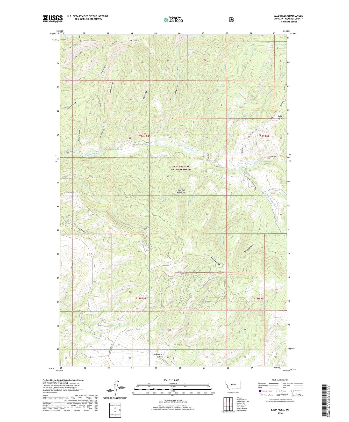
Bald Hills Montana US Topo Map
Couldn't load pickup availability
Also explore the Bald Hills Forest Service Topo of this same quad for updated USFS data
2024 topographic map quadrangle Bald Hills in the state of Montana. Scale: 1:24000. Based on the newly updated USGS 7.5' US Topo map series, this map is in the following counties: Meagher. The map contains contour data, water features, and other items you are used to seeing on USGS maps, but also has updated roads and other features. This is the next generation of topographic maps. Printed on high-quality waterproof paper with UV fade-resistant inks.
Quads adjacent to this one:
West: Lingshire NE
Northwest: Millegan
North: Deep Creek Park
Northeast: Blankenbaker Flats
East: Monument Peak
Southeast: Sheep Mountain
South: Devils Footstool
Southwest: Ellis Canyon
This map covers the same area as the classic USGS quad with code o46111h2.
Contains the following named places: Bald Hills, Barrel Coulee, Bear Creek, Coyote Creek, Daisy Creek, Daisy Spring, Deadman Gulch, Double Gulch, Ducolon-Potter Mine, Indiana Gulch, Lion Gulch, Lobley Gulch, Miners Creek, Mongar Creek, NW NW Section 26 Mine, Old Baldy, Post Creek, South Fork Tenderfoot Creek, Strawberry Gulch, Zehntner Ranch