MyTopo
Blizzard Reservoir Montana US Topo Map
Couldn't load pickup availability
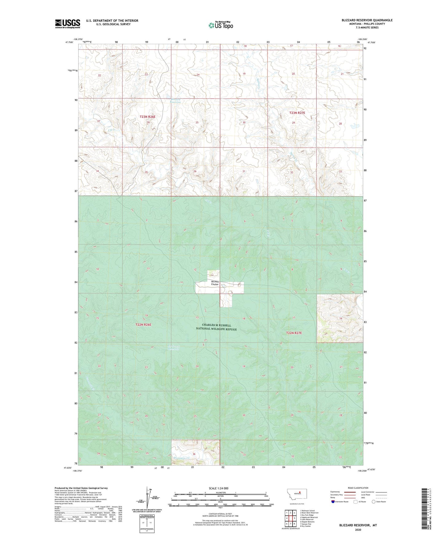
2024 topographic map quadrangle Blizzard Reservoir in the state of Montana. Scale: 1:24000. Based on the newly updated USGS 7.5' US Topo map series, this map is in the following counties: Phillips. The map contains contour data, water features, and other items you are used to seeing on USGS maps, but also has updated roads and other features. This is the next generation of topographic maps. Printed on high-quality waterproof paper with UV fade-resistant inks.
Quads adjacent to this one:
West: Sagebrush Reservoir
Northwest: Robinson School
North: Bison Bone Reservoir
Northeast: Dry Fork Ridge
East: Lake Reservoir
Southeast: Dry Coulee
South: Hanson Flat
Southwest: Kepple Bottoms
This map covers the same area as the classic USGS quad with code o47108f3.
Contains the following named places: 22N26E15CC__01 Well, 22N26E35AA__01 Well, 22N27E08CB__01 Well, Big Snowy Reservoir, Blizzard Reservoir, Nichols Coulee Camp, Spring Creek