MyTopo
Dry Fork Ridge Montana US Topo Map
Couldn't load pickup availability
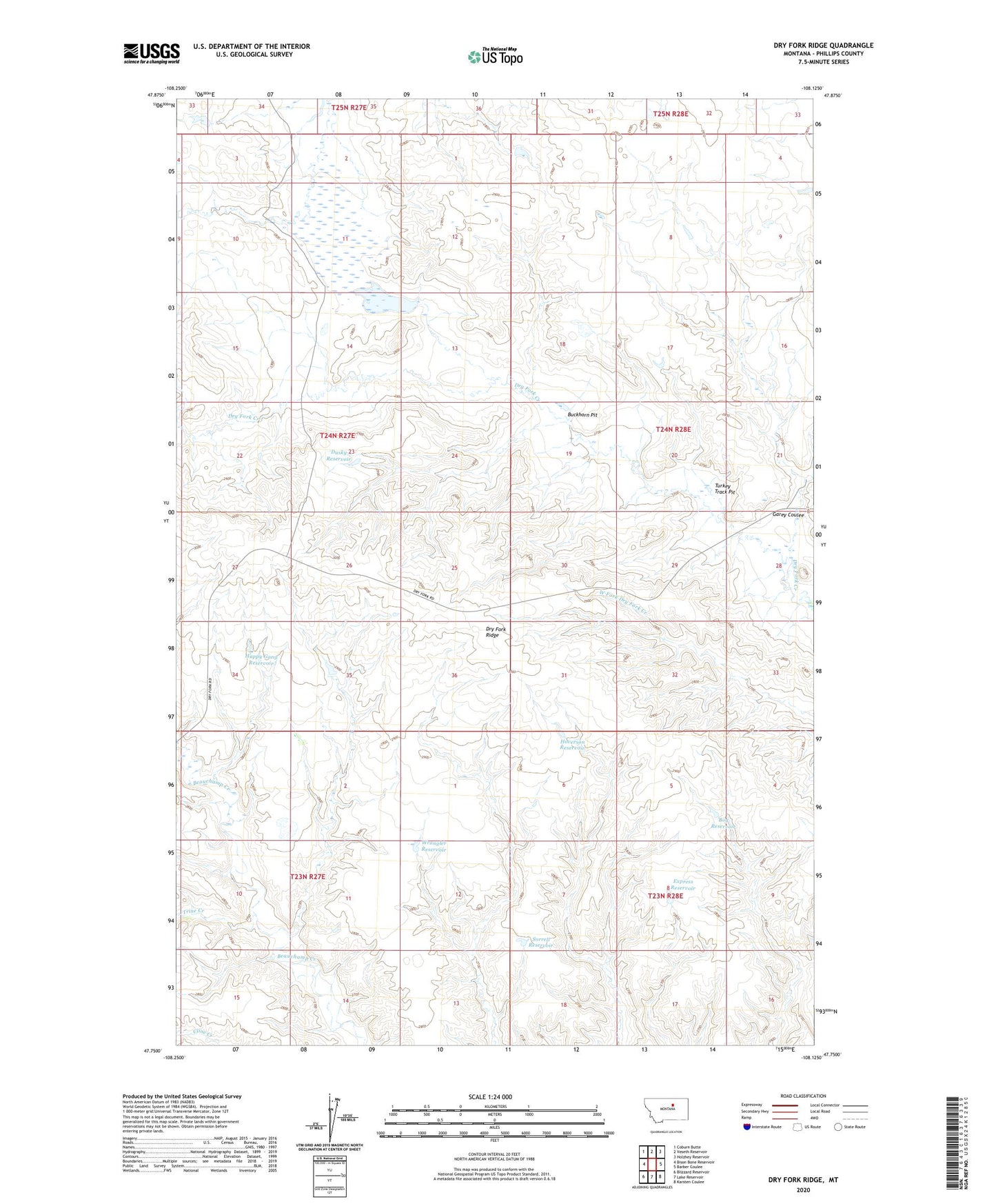
2024 topographic map quadrangle Dry Fork Ridge in the state of Montana. Scale: 1:24000. Based on the newly updated USGS 7.5' US Topo map series, this map is in the following counties: Phillips. The map contains contour data, water features, and other items you are used to seeing on USGS maps, but also has updated roads and other features. This is the next generation of topographic maps. Printed on high-quality waterproof paper with UV fade-resistant inks.
Quads adjacent to this one:
West: Bison Bone Reservoir
Northwest: Coburn Butte
North: Veseth Reservoir
Northeast: Holzhey Reservoir
East: Barber Coulee
Southeast: Karsten Coulee
South: Lake Reservoir
Southwest: Blizzard Reservoir
This map covers the same area as the classic USGS quad with code o47108g2.
Contains the following named places: 23N28E06CCAD01 Well, Bog Reservoir, Buckhorn Pit, Current Dam, Dry Fork Ridge, Dusky Reservoir, Express Reservoir, Garey Coulee, Happy Gang Reservoir, Hoverson Reservoir, Isaac Frye Number 1 Dam, Isaac Frye Number 4 Dam, PR-11 Dam, Sorrell Reservoir, Trine Creek, Turkey Track Pit, Wrangler Reservoir