MyTopo
Sagebrush Reservoir Montana US Topo Map
Couldn't load pickup availability
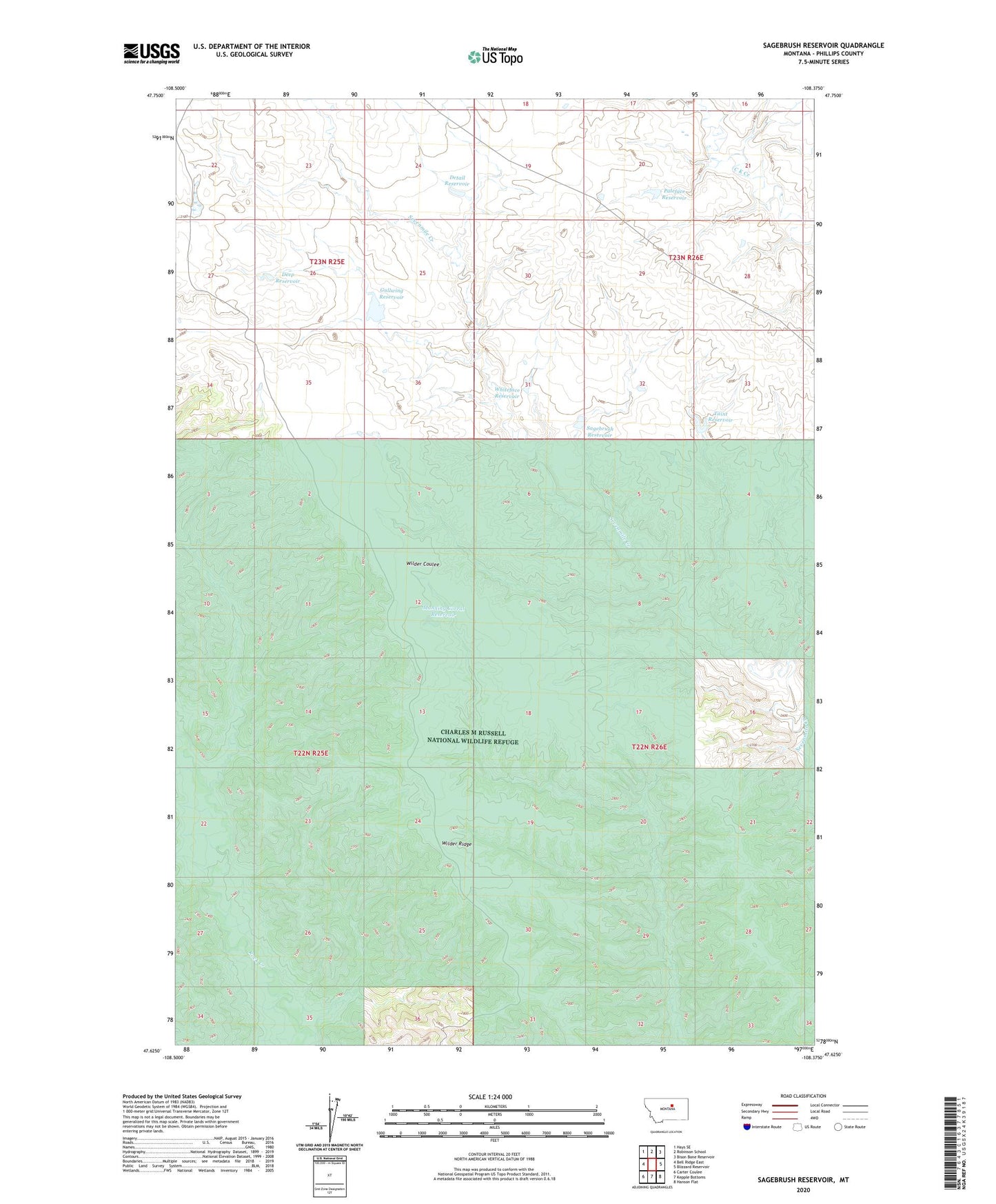
2024 topographic map quadrangle Sagebrush Reservoir in the state of Montana. Scale: 1:24000. Based on the newly updated USGS 7.5' US Topo map series, this map is in the following counties: Phillips. The map contains contour data, water features, and other items you are used to seeing on USGS maps, but also has updated roads and other features. This is the next generation of topographic maps. Printed on high-quality waterproof paper with UV fade-resistant inks.
Quads adjacent to this one:
West: Bell Ridge East
Northwest: Hays SE
North: Robinson School
Northeast: Bison Bone Reservoir
East: Blizzard Reservoir
Southeast: Hanson Flat
South: Kepple Bottoms
Southwest: Carter Coulee
This map covers the same area as the classic USGS quad with code o47108f4.
Contains the following named places: Deep Reservoir, Detail Reservoir, Gullwing Reservoir, Lazy J-D Number 4 Dam, Manning Corral Prairie Dog Town, Manning Corral Reservoir, Paleface Dam, Paleface Reservoir, Sagebrush Number 2 Dam, Sagebrush Reservoir, Taint Dam, Taint Reservoir, Whiteface Dam, Whiteface Reservoir, Wilder Ridge